


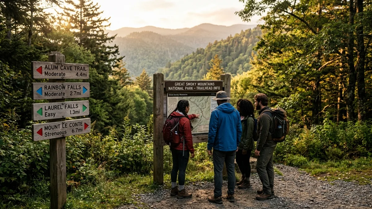
The Great Smoky Mountains National Park features over 800 miles of smoky mountain hiking trails ranging from wheelchair-accessible boardwalks to grueling 14-mile mountain summits. The key to choosing the right trail lies in understanding how elevation gain, trail conditions, seasonal weather, and your group’s fitness level combine to create the actual difficulty you’ll experience on the ground.
TL;DR: Essential Smoky Mountain Trail Facts
- The park contains 150 official hiking trails across 800+ miles, from easy 0.5-mile loops to strenuous 14-mile mountain climbs
- Elevation gain matters more than distance: a 3-mile trail with 1,500 feet of elevation feels harder than a 5-mile flat trail
- Trail difficulty varies dramatically by season due to weather, mud, ice, and seasonal closures affecting accessibility
- Popular trails like Laurel Falls see 2 million visitors annually while hidden gems remain virtually empty
- Bears are most active April through October, requiring specific safety protocols on all backcountry trails
- Current trail conditions change weekly due to weather, maintenance, and seasonal factors requiring real-time updates
Introduction
Choosing the wrong trail difficulty can turn a perfect mountain day into an exhausting ordeal or boring walk. Generic difficulty ratings often fail because they don’t account for seasonal mud, crowd levels, actual elevation profiles, or what “moderate” means for a family with young children versus experienced hikers.
As local cabin rental managers who have guided thousands of guests to appropriate trails over the years, we’ve learned that the best difficulty system considers multiple factors beyond simple distance measurements. Weather transforms easy trails into challenging slogs, while seasonal crowds can make moderate hikes feel strenuous due to constant stops and bottlenecks.
This comprehensive rating system evaluates each major trail across six criteria: elevation gain per mile, technical terrain difficulty, seasonal accessibility, typical crowd levels, safety considerations, and time requirements. Whether you’re planning your first Smokies adventure or your fiftieth, these realistic ratings will help you choose trails that match your group’s abilities and expectations.
How Do Smoky Mountain Trail Difficulty Ratings Actually Work?
Most trail rating systems oversimplify difficulty into three categories that don’t reflect reality. A trail rated “moderate” might be perfect for athletic teenagers but exhausting for older adults, or vice versa. Understanding the factors that create actual difficulty helps you choose appropriately.
Elevation gain per mile provides the most reliable difficulty indicator. Trails gaining less than 200 feet per mile feel easy for most hikers. Between 200-400 feet per mile creates moderate exertion. Above 400 feet per mile becomes strenuous, with anything over 600 feet per mile requiring serious fitness preparation.
Traditional Rating Problems
The National Park Service rates trails as Easy, Moderate, or Strenuous based primarily on distance and total elevation. This creates misleading classifications where a 5-mile flat trail receives the same “moderate” rating as a 3-mile trail with 1,500 feet of climbing.
Commercial hiking websites often use star systems or numerical scales that vary between sources. AllTrails might rate a trail 3 stars while Hiking in the Smokys calls the same trail “difficult,” leaving hikers confused about actual expectations.
Realistic Difficulty Factors
Trail surface conditions significantly impact difficulty beyond elevation statistics. Rocky, root-covered paths require constant attention and slow progress. Well-maintained gravel paths allow steady, predictable hiking pace regardless of incline.
Seasonal weather transforms difficulty ratings dramatically. Spring mud season can double hiking times on moderate trails. Winter ice makes easy trails dangerous without proper equipment. Summer heat and humidity increase exertion levels across all difficulty categories.
Crowd levels affect difficulty through constant stopping, limited parking, and trail congestion. Popular trails like visitor center areas experience bottlenecks that extend hiking times significantly during peak seasons.
What Are the Best Easy Smoky Mountain Hiking Trails for Beginners?
Easy trails in the Smokies accommodate wheelchairs, strollers, and hikers of all ages with minimal elevation gain and well-maintained surfaces. These paths offer rewarding destinations without serious physical demands.
Gatlinburg Trail (1.9 miles roundtrip)
This fully paved, wheelchair-accessible trail follows the West Prong Little Pigeon River from downtown Gatlinburg to the Sugarlands Visitor Center. The gentle grade gains only 50 feet over nearly 2 miles, making it perfect for families with small children or mobility concerns.
The trail runs parallel to busy Newfound Gap Road, so expect significant traffic noise throughout. Early morning hiking before 9am provides the quietest experience. Free parking is available at both trailheads, though the Gatlinburg end fills quickly during peak season.
Spruce Flat Falls (2 miles roundtrip)
Located in the Tremont area, this easy trail gains 340 feet over 1 mile to reach a 30-foot cascade. The wide, well-maintained path crosses several small streams on sturdy bridges, making it accessible for most fitness levels.
The waterfall flows year-round but reaches peak volume during spring snowmelt and after summer storms. Swimming is not recommended due to dangerous currents and submerged rocks. Plan 1.5-2 hours for the complete roundtrip including waterfall viewing time.
Porters Creek (4.0 miles roundtrip)
This historical trail starts at the Greenbrier entrance and gains 699 feet over 2 miles. The path passes several preserved cabins and homestead ruins, offering cultural interest alongside natural beauty. Stream crossings on wooden bridges add scenic variety without technical difficulty.
The trail becomes muddy during wet seasons due to horse use on the same path. Waterproof boots are recommended from November through April. Most hikers complete the roundtrip in 2-3 hours with stops to explore historical sites.
Which Moderate Trails Offer the Best Balance of Challenge and Scenery?
Moderate trails provide substantial rewards through waterfalls, views, or historical sites while remaining accessible to reasonably fit hikers. These routes typically involve 2-6 miles of hiking with elevation gains between 500-1,500 feet.
Laurel Falls Trail (2.6 miles roundtrip)
The park’s most popular waterfall hike attracts over 2 million visitors annually to see the 80-foot cascade. The paved trail gains 314 feet over 1.3 miles, making it technically easy but crowded conditions increase difficulty through constant navigation around slower groups.
Peak crowding occurs from 10am-4pm daily during summer and fall seasons. Early morning starts before 8am or late afternoon hikes after 5pm provide the best experience. Parking fills completely by 9am on weekends from May through October.
Alum Cave Trail (4.4 miles roundtrip)
This iconic trail gains 1,125 feet over 2.2 miles to reach the dramatic Alum Cave Bluffs. The path features diverse terrain including old-growth forest, stream crossings, and exposed rock faces that require careful footing.
The trail becomes increasingly technical after the first mile, with steep sections and narrow passages along cliff faces. Steel cables provide handholds during the final approach to Alum Cave. Allow 3-4 hours for the complete roundtrip with exploration time.
Abrams Falls (5.2 miles roundtrip)
Starting from the Cades Cove loop road, this trail gains 675 feet over 2.6 miles to reach a powerful 20-foot waterfall. The relatively gentle grade makes it accessible to most hikers, though stream crossings can be challenging during high water periods.
The trail follows Abrams Creek through hardwood forests with excellent wildflower displays in April and May. Swimming in the pool below the falls is possible but dangerous due to strong currents and underwater obstacles. Most hikers complete the journey in 3-4 hours including waterfall time.
What Makes Strenuous Trails Worth the Extra Effort?
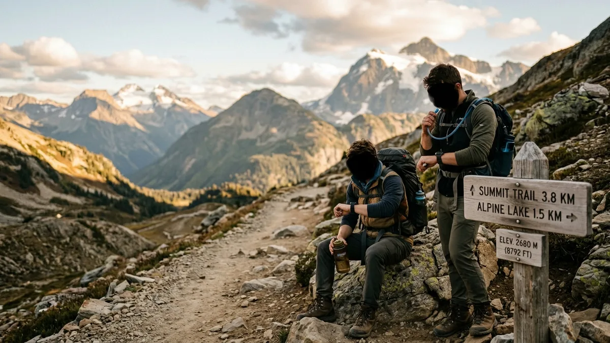
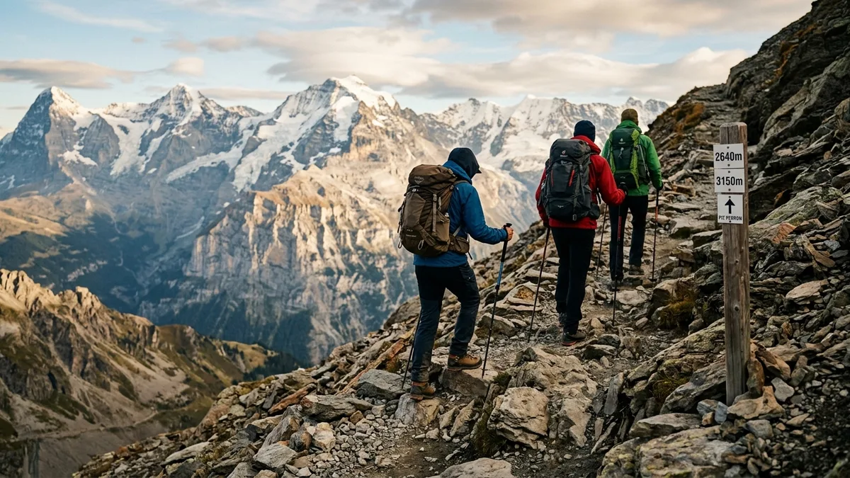
Strenuous smoky mountain hiking trails demand serious physical preparation but reward hikers with spectacular views, pristine wilderness, and fewer crowds. These challenging routes typically exceed 1,500 feet of elevation gain and require 6+ hours to complete.
Mount LeConte via Alum Cave (11.0 miles roundtrip)
Tennessee’s third-highest peak rises 2,763 feet over 5.5 miles of increasingly difficult terrain. The route follows the Alum Cave Trail for the first 2.2 miles before continuing through alpine terrain to the 6,593-foot summit.
Beyond Alum Cave, the trail becomes significantly more challenging with steep switchbacks, exposed rock scrambles, and potential for sudden weather changes. Snow and ice are possible from November through March, requiring traction devices and winter hiking experience.
LeConte Lodge operates seasonally near the summit, providing overnight accommodations for advance reservations. Day hikers should start before 7am to complete the challenging roundtrip before dark. Allow 8-10 hours including summit time and rest breaks.
Charlies Bunion (8.1 miles roundtrip)
This dramatic rocky outcrop provides panoramic views across the Smoky Mountains after gaining 1,640 feet over 4 miles. The trail follows the Appalachian Trail from Newfound Gap, offering excellent footing on well-maintained paths.
The hike passes through several distinct ecosystems from hardwood coves to spruce-fir forests near the ridge. Weather conditions can change rapidly at the 5,375-foot elevation, requiring layers and rain protection even during summer months.
Strong winds are common at Charlies Bunion, making the exposed rock face dangerous during storms. Check weather forecasts carefully and avoid the hike during high wind or thunderstorm conditions. Most experienced hikers complete the roundtrip in 5-6 hours.
Rocky Top via Thunderhead (13.9 miles roundtrip)
Made famous by the Tennessee state song, Rocky Top and Thunderhead Mountain requires 3,655 feet of elevation gain over nearly 7 miles. This extremely challenging hike rewards dedicated hikers with 360-degree mountain views and bragging rights.
The trail starts from Cades Cove and climbs relentlessly through old-growth forests to reach the grassy balds at Thunderhead Mountain. Rocky Top lies another 0.7 miles beyond Thunderhead along the Appalachian Trail.
Weather exposure becomes severe above 5,000 feet elevation, with potential for hypothermia even during summer due to wind and sudden temperature drops. This hike requires excellent physical conditioning, proper gear, and early morning starts. Plan 10-12 hours for the complete adventure.
How Do Seasonal Conditions Change Trail Difficulty Ratings?
Trail conditions vary dramatically throughout the year in the Smokies, turning easy summer hikes into challenging winter expeditions. Understanding seasonal impacts helps choose appropriate trails and gear for safe, enjoyable hiking.
Spring Season Challenges (March-May)
Spring brings unpredictable weather, muddy conditions, and increased bear activity as animals emerge from winter dormancy. Trails at higher elevations may still have snow and ice while lower elevations experience heavy rain and flooding.
Mud season typically peaks in April when snowmelt combines with spring rains to create challenging trail conditions. Popular trails like Alum Cave and Chimney Tops become significantly more difficult due to slippery rocks and saturated soil.
Wildflower season attracts heavy crowds to moderate trails, increasing difficulty through congestion and limited parking. Trilliums peak in mid-April while mountain laurel blooms in May, drawing photographers and nature enthusiasts to previously quiet trails.
Summer Heat and Humidity (June-August)
High temperatures and humidity increase exertion levels across all trail categories. Easy trails become more challenging due to dehydration risk and heat exhaustion potential. Strenuous trails require early morning starts to avoid dangerous afternoon heat.
Thunderstorms develop quickly during summer afternoons, creating lightning hazards on exposed ridges and dangerous flash flood conditions in stream valleys. Morning hiking reduces weather risks while providing cooler temperatures and better wildlife viewing.
Peak visitor season creates extreme crowding on popular trails. Parking lots fill by 8am on weekends, while trail congestion slows hiking pace significantly. Less popular trails offer better experiences during summer months.
Fall Foliage Impact (September-November)
Fall colors attract the heaviest visitor numbers of the year, making moderate trails feel strenuous due to extreme crowding and parking challenges. October weekends see traffic jams extending several miles from popular trailheads.
Cooler temperatures make strenuous trails more accessible to average hikers, but increased visitation eliminates the solitude typically found on challenging routes. Early morning starts become essential for parking availability and trail space.
Leaf-covered trails create slippery conditions and obscured footing hazards. Rocky sections become particularly dangerous with wet leaves hiding loose stones and root systems. Trekking poles and careful footwork become necessary on technical terrain.
Winter Conditions (December-February)
Snow and ice transform trail difficulty ratings completely. Easy summer trails become treacherous without proper traction devices. Moderate trails require winter hiking experience and specialized gear for safe completion.
Higher elevation trails above 4,000 feet regularly receive snow and freezing temperatures from December through March. Popular destinations like Clingmans Dome road close completely, adding significant mileage to normally accessible trails.
Daylight hours limit hiking time severely during winter months. Most trails require headlamps and early starts to complete safely before dark. Emergency gear becomes essential due to rapid weather changes and potential for getting caught in storms.
Which Trails Avoid Crowds While Offering Great Experiences?
Hidden gems throughout the Smokies provide excellent hiking without the crowds that plague popular destinations. These lesser-known trails offer solitude, wildlife viewing opportunities, and unique features while maintaining reasonable difficulty levels.
Baskins Creek Trail (3.0 miles roundtrip)
This moderate trail near Gatlinburg gains 580 feet over 1.5 miles to reach a secluded 25-foot waterfall. The trailhead is tucked away on Baskins Creek Road, keeping visitor numbers low compared to nearby popular destinations.
The path follows old roadbeds through second-growth forest before narrowing to single-track trail near the falls. Stream crossings require careful rock hopping during high water periods. Allow 2-3 hours for the complete hike including falls exploration.
Grotto Falls via Trillium Gap (2.6 miles roundtrip)
While Grotto Falls attracts moderate crowds, the complete Trillium Gap Trail continues beyond the falls for excellent solitude and mountain views. The initial 1.3 miles to the falls gains 585 feet through old-growth hemlock forest.
The unique feature of walking behind the 25-foot waterfall makes this destination special despite moderate popularity. Early morning visits before 9am typically provide falls access without crowds. The trail beyond Grotto Falls continues for additional mileage with minimal visitor encounters.
Rich Mountain Loop (8.5 miles roundtrip)
This challenging loop hike starts from the Cades Cove area but avoids the heavy traffic of the loop road itself. The trail gains 1,740 feet over varied terrain including old homestead sites and excellent views from Rich Mountain fire tower.
Most visitors stick to the Cades Cove driving loop, leaving this substantial hike to serious hikers seeking solitude. The loop can be hiked in either direction, though counterclockwise provides gentler initial climbing. Plan 6-8 hours for the complete circuit including exploration stops.
Three Sisters Falls (2.6 miles roundtrip)
Located near Pigeon Forge, this trail receives surprisingly light use despite easy accessibility and beautiful waterfall destination. The path gains 400 feet over 1.3 miles through mixed forest to reach three distinct cascades totaling 90 feet.
Limited parking at the trailhead naturally controls visitor numbers while nearby Laurel Falls attracts the majority of waterfall seekers. The trail requires stream crossings that can be challenging during high water but adds adventure to the hiking experience.
What Wildlife Safety Protocols Apply to Different Trail Difficulties?
Bear encounters and wildlife safety considerations vary significantly between easy, developed trails and remote backcountry routes. Understanding appropriate safety protocols for each difficulty level ensures enjoyable, safe hiking experiences throughout the Smokies.
Easy Trail Wildlife Considerations
Developed trails like Gatlinburg Trail and Laurel Falls see frequent human traffic, which typically keeps bears and other wildlife at safe distances. However, food conditioning from improper visitor behavior can create dangerous situations even on busy trails.
Never feed wildlife regardless of trail difficulty or animal size. Chipmunks and squirrels on easy trails can carry diseases and their habituation to human food creates aggressive behavior toward future hikers, especially children.
Stay alert even on paved trails, as bears occasionally appear near developed areas searching for improperly stored food or garbage. Keep children close and make noise when walking through areas with limited visibility around trail bends.
Moderate Trail Bear Safety
Trails like Alum Cave and Abrams Falls penetrate deeper into bear habitat while still maintaining moderate visitor numbers. These routes require enhanced awareness and proper food storage even on day hikes.
Carry bear spray in easily accessible locations when hiking moderate trails during active bear seasons (April-October). Practice proper deployment techniques before hiking, as bears can charge at speeds exceeding 30 mph with little warning.
Make noise while hiking, especially around stream areas where water sounds mask human approach. Bears surprised at close range are more likely to react defensively. Clapping hands, talking loudly, or wearing bear bells helps announce your presence.
Strenuous Trail Backcountry Protocols
Remote trails like Mount LeConte and Rocky Top require full backcountry safety protocols due to limited rescue access and increased wildlife encounters. Bear activity intensifies in remote areas where human presence is minimal.
Pack all scented items including toiletries, sunscreen, and snack wrappers in bear-proof containers or proper food storage techniques. Even day hikers on strenuous trails should follow overnight backpacking food storage guidelines.
Travel in groups of four or more when possible on remote trails. Bear attacks on groups are extremely rare compared to solo hikers or pairs. Larger groups make more noise naturally while providing better response options during wildlife encounters.
Carry emergency communication devices like satellite messengers on trails exceeding 6 miles or gaining more than 2,000 feet elevation. Cell phone coverage is unreliable in remote areas, and rescue response times increase significantly with distance from trailheads.
How Do Trail Conditions and Maintenance Schedules Affect Difficulty?
Trail maintenance schedules and current conditions dramatically impact hiking difficulty beyond published ratings. Recent storms, seasonal maintenance work, and ongoing construction projects can transform easy trails into challenging obstacles or close popular routes entirely.
Seasonal Maintenance Impacts
The National Park Service conducts major trail maintenance during spring and fall seasons when visitor numbers are lower. Popular trails like Laurel Falls and Alum Cave may experience temporary closures or detours that increase hiking difficulty significantly.
Bridge repairs and reconstruction projects can eliminate stream crossings, forcing hikers to ford potentially dangerous waterways. Check current trail conditions through the official hiking safety updates before attempting any moderate or strenuous trails.
Blowdown removal following major storms can leave trails temporarily impassable or require technical scrambling over fallen trees. Winter storms and spring floods create the most significant trail damage requiring extensive maintenance efforts.
Weather-Related Condition Changes
Heavy rainfall transforms well-maintained trails into muddy, slippery challenges that increase difficulty ratings substantially. Clay-based soils common in the Smokies become particularly treacherous when saturated with water.
Flash flooding can wash out trail sections entirely, creating dangerous gaps or unstable footing that persists for weeks after storm events. Stream crossings become impossible during high water, effectively closing trails regardless of official status.
Freeze-thaw cycles during winter and early spring create hazardous ice conditions on north-facing slopes and shaded trail sections. Easy trails can become dangerous without proper footwear and traction devices during these periods.
Real-Time Condition Resources
The National Park Service maintains current trail condition reports through their official website and visitor center updates. However, conditions change rapidly and reports may lag behind actual trail status by several days.
Local hiking groups and social media communities provide more timely condition updates from recent hikers. Facebook groups and hiking forums often contain valuable information about current trail hazards, parking availability, and recent maintenance work.
Visitor centers at Sugarlands and Oconaluftee provide the most current information available, including recent hiker reports and ranger observations. Stop at visitor centers before attempting challenging trails or during questionable weather periods.
Which Smoky Mountain Trails Are Actually Wheelchair Accessible?
True wheelchair accessibility in mountain terrain is limited but several excellent trails accommodate mobility devices through paved surfaces and gentle grades. These routes provide meaningful nature experiences without requiring walking ability.
Fully Accessible Paved Trails
The Gatlinburg Trail offers 1.9 miles of completely paved, level terrain suitable for wheelchairs, strollers, and mobility scooters. The trail connects downtown Gatlinburg to Sugarlands Visitor Center with minimal elevation change and excellent surface conditions.
Sugarlands Valley Nature Trail provides a 0.5-mile loop on boardwalk and paved surfaces with interpretive signs describing local ecology. The trail stays level throughout while offering stream views and forest immersion without significant barriers.
Cades Cove Loop Road allows vehicle access to wildlife viewing and historical sites over 11 miles of paved road. While not technically a hiking trail, the loop provides nature experiences accessible to all mobility levels with numerous parking areas for extended stops.
Partially Accessible Options
Several trails offer partial accessibility before encountering barriers that prevent wheelchair passage. These routes provide meaningful experiences for the accessible portions while clearly marking where difficulties begin.
Laurel Falls Trail is paved for the complete 1.3 miles to the waterfall but includes moderate grades that challenge manual wheelchairs. Electric wheelchairs and mobility scooters typically handle the incline successfully with some effort required.
Oconaluftee River Trail offers 1.5 miles of paved, level walking from the visitor center toward Cherokee. The trail provides excellent wildlife viewing opportunities and historical sites along a peaceful river setting suitable for most mobility devices.
Accessible Facility Information
All major trailheads include accessible parking spaces and restroom facilities meeting ADA requirements. However, parking availability varies significantly during peak seasons, with accessible spaces often occupied by visitors without mobility needs.
Visitor centers at Sugarlands and Oconaluftee provide detailed accessibility information, trail maps highlighting accessible routes, and assistance planning appropriate activities for visitors with mobility limitations.
What Should You Pack for Different Smoky Mountain Trail Difficulties?
Proper gear varies dramatically between easy nature walks and strenuous mountain climbs. Packing appropriately for trail difficulty prevents discomfort, safety issues, and hiking emergencies while avoiding unnecessary weight for shorter, easier routes.
Easy Trail Essentials
Short, developed trails require minimal specialized gear but basic preparation prevents common problems. Water bottles provide adequate hydration for hikes under 2 hours on easy terrain with reliable access to facilities.
Comfortable walking shoes with good tread suffice for paved or well-maintained easy trails. Running shoes or casual hiking shoes provide adequate support without the weight and expense of hiking boots for these shorter adventures.
Light snacks, sunscreen, and basic first aid supplies handle most needs on easy trails. Camera or smartphone captures memories while small backpacks or daypacks carry essentials without becoming burdensome during short hikes.
Moderate Trail Requirements
Moderate trails lasting 2-6 hours require enhanced preparation due to increased distance from facilities and variable terrain conditions. Hiking boots or sturdy trail shoes provide necessary ankle support and traction on technical sections.
Carry more water than seems necessary, approximately 1 liter per 2 hours of hiking time during moderate exertion. Dehydration occurs rapidly in mountain terrain and recovery options are limited once symptoms appear.
Trail maps, compass, or GPS devices become important on moderate trails where path finding challenges may arise. Weather protection including rain layers and extra clothing layers prepare hikers for changing mountain conditions.
Strenuous Trail Preparation
Challenging trails exceeding 6 miles or 2,000 feet of elevation gain require comprehensive preparation and emergency planning. Quality hiking boots provide essential support and protection during long days on technical terrain.
Emergency shelter, extra food, and first aid supplies become critical on remote trails where rescue access is limited. Headlamps or flashlights with extra batteries prepare hikers for unexpected delays or early darkness.
Navigation equipment including detailed topographic maps, compass, and GPS devices are essential for strenuous trails. Weather can change rapidly at higher elevations, creating visibility challenges that make navigation difficult without proper equipment.
Emergency communication devices like satellite messengers provide crucial safety backup on remote trails. Cell phone coverage is unreliable throughout much of the backcountry, making alternative communication methods necessary for serious emergencies.
How Do Multi-Day Hiking Itineraries Work in the Smokies?
Multi-day hiking adventures in the Great Smoky Mountains require careful planning due to limited overnight options and backcountry permit requirements. However, strategic base camping allows hikers to tackle multiple trails while returning to comfortable accommodations each night.
Backcountry Camping Options
The park maintains 15 backcountry shelters and 104 backcountry campsites accessible only by hiking. Advance reservations are required for all overnight backcountry use through the official permit system, with popular sites booking months ahead during peak seasons.
The Appalachian Trail corridor through the Smokies offers the most developed backcountry camping infrastructure with shelters spaced for reasonable daily hiking distances. However, these sites experience the heaviest use and most restrictive reservation requirements.
Backcountry camping requires bear-proof food storage, Leave No Trace principles, and wilderness camping experience. First-time backcountry users should consider guided trips or extensive preparation before attempting independent overnight hiking.
Base Camp Strategy
Comfortable cabin accommodations near trailheads allow hikers to attempt multiple challenging trails without backcountry camping. This approach provides hot showers, comfortable beds, and gear drying between hiking days while accessing remote trail systems.
Strategic accommodation placement allows access to different trail systems from the same base. Gatlinburg provides access to Mount LeConte, Alum Cave, and Chimney Tops. Cades Cove area accommodations access Abrams Falls, Rich Mountain, and Gregory Bald routes.
Multi-day itineraries can combine different difficulty levels to provide rest days between strenuous efforts. Easy recovery hikes following challenging summit attempts prevent overexertion while maintaining active vacation schedules.
Seasonal Planning Considerations
Spring and fall provide optimal weather for multi-day hiking but require flexible itineraries due to unpredictable conditions. Weather can change rapidly in mountain terrain, making backup indoor plans essential during transitional seasons.
Summer offers most reliable weather but requires early morning starts to avoid afternoon heat and thunderstorms. Longer daylight hours allow more ambitious daily hiking schedules during peak summer months.
Winter multi-day hiking requires extensive cold weather experience and specialized gear. However, crowd avoidance and pristine winter scenery reward prepared hikers willing to tackle challenging conditions safely.
What Are the Real Costs and Budget Considerations for Smoky Mountain Hiking?
Hiking costs in the Great Smoky Mountains vary significantly based on trail choices, gear needs, and accommodation preferences. Understanding realistic budget requirements helps plan affordable hiking vacations without compromising safety or enjoyment.
Free and Low-Cost Hiking Options
The Great Smoky Mountains National Park charges no entrance fees, making trail access completely free once you reach trailheads. This represents exceptional value compared to other major national parks that charge $25-35 entrance fees.
Parking at most trailheads is free but limited, especially during peak seasons. Early arrival or off-season hiking avoids parking challenges while maintaining zero-cost trail access. Popular trails may require alternative parking with short walks to actual trailheads.
Basic day hiking requires minimal gear investment for easy and moderate trails. Good walking shoes, water bottles, and simple daypacks provide adequate equipment for most trail experiences without significant upfront costs.
Gear Investment Considerations
Quality hiking boots range from $100-300 but provide years of reliable service for serious hikers. Less expensive alternatives work well for occasional hiking but may cause discomfort or safety issues on challenging terrain.
Rain gear, layers, and navigation equipment represent additional investments for moderate and strenuous trails. However, these purchases enhance safety and comfort across multiple hiking trips, making the per-use cost reasonable for active hikers.
Rental options exist for specialized gear like camping equipment or GPS devices through outdoor retailers in Gatlinburg and nearby areas. Rental fees typically cost 10-20% of purchase prices, making them attractive for infrequent use.
Accommodation and Meal Planning
Accommodation costs vary widely based on location, season, and group size. Budget motels near park entrances start around $60-80 per night during off-season, while luxury cabins can exceed $300-500 per night during peak times.
Meal preparation capabilities significantly impact hiking vacation budgets. Cabin accommodations with full kitchens allow group meal preparation at much lower costs than restaurant dining for every meal during multi-day stays.
Grocery stores in Gatlinburg, Pigeon Forge, and Sevierville provide trail food and meal preparation supplies. However, prices in tourist areas typically exceed normal grocery costs by 20-30% compared to shopping before arrival.
Frequently Asked Questions
What is the best hike in the Smoky Mountains for different skill levels?
For beginners, the Gatlinburg Trail offers the best introduction with its paved, wheelchair-accessible 1.9-mile route along the river. Intermediate hikers should try Laurel Falls for the iconic waterfall experience with moderate crowds and maintained trails. Advanced hikers will find Mount LeConte via Alum Cave provides the ultimate Smokies challenge with diverse terrain and spectacular summit views.
How long is the 3 Sisters Falls hike and what difficulty level?
The Three Sisters Falls hike covers 2.6 miles roundtrip with 400 feet of elevation gain over 1.3 miles each way. This rates as easy to moderate difficulty, suitable for most hikers including families with children over 8 years old. The trail requires stream crossings that can be challenging during high water periods but offers excellent waterfall rewards for the modest effort required.
Can a beginner hike Mount LeConte successfully?
Mount LeConte is not recommended for beginners due to its 11-mile length, 2,763 feet of elevation gain, and technical terrain beyond Alum Cave. New hikers should build experience on moderate trails like Laurel Falls and Alum Cave Trail before attempting LeConte. The summit requires 8-10 hours of strenuous hiking with potential weather hazards and navigation challenges unsuitable for inexperienced hikers.
Can you go hiking year-round in the Smoky Mountains?
Yes, hiking is possible year-round in the Smokies, but seasonal conditions dramatically affect trail accessibility and difficulty. Summer offers the most reliable conditions, while winter requires specialized gear and experience due to snow, ice, and short daylight hours. Spring brings mud season and unpredictable weather, while fall offers excellent conditions but extreme crowding during peak foliage season.
Which trails have the least crowds and when should you hike them?
Baskins Creek Falls, Rich Mountain Loop, and Three Sisters Falls see significantly fewer visitors than popular destinations like Laurel Falls or Chimney Tops. Early morning hiking before 8am on any trail provides the best crowd avoidance, while weekdays during school sessions offer the quietest trail experiences. Winter months provide ultimate solitude but require proper preparation for cold weather conditions.
What are the specific bear safety protocols for Smoky Mountain trails?
Make noise while hiking, travel in groups of four or more when possible, and carry bear spray in accessible locations during active seasons (April-October). Store all food and scented items properly even on day hikes, and never feed wildlife regardless of species. If you encounter a bear, do not run; instead, back away slowly while making yourself appear large and speak in calm, loud tones until the bear leaves the area.
How do I find real-time trail conditions and closure information?
Check the official National Park Service website and stop at visitor centers for the most current trail condition reports. Local hiking groups on social media platforms often provide more timely updates from recent hikers. Weather conditions can close trails rapidly due to flooding, ice, or storm damage, so verify current status before attempting moderate or strenuous routes, especially during winter and spring seasons.
Conclusion
The Great Smoky Mountains’ 800+ miles of trails offer appropriate challenges for every fitness level when you understand realistic difficulty factors beyond simple distance measurements. Elevation gain per mile, seasonal conditions, crowd levels, and trail maintenance status combine to create actual hiking difficulty that often differs significantly from published ratings.
Success in choosing appropriate smoky mountain hiking trails depends on honest assessment of your group’s abilities, current fitness levels, and experience with mountain terrain. Easy trails provide rewarding experiences for families and beginning hikers, while strenuous routes challenge experienced adventurers with spectacular summit views and wilderness solitude.
Weather and seasonal timing dramatically impact trail difficulty, turning moderate summer hikes into challenging winter expeditions requiring specialized gear and experience. Planning trips during optimal seasons while maintaining flexible itineraries accommodates the unpredictable mountain weather that defines Smoky Mountain hiking throughout the year.

After a challenging day on the trails, Smoky Mountain Serenity Lodge provides the perfect recovery base with its rooftop hot tub and cedar sauna. The luxury retreat sits minutes from major trailheads while offering panoramic forest views that rival any summit. Check availability for your hiking adventure.