
The Gatlinburg Trail is a 4-mile roundtrip path inside Great Smoky Mountains National Park that connects the Sugarlands Visitor Center to River Road at the edge of downtown Gatlinburg. With only 235 feet of total elevation gain, it earns a difficulty rating of Easy and stands as one of only two trails in the entire park where leashed dogs and bicycles are permitted.
- The Gatlinburg Trail runs approximately 4 miles (6.4 km) roundtrip with 235 feet of total elevation gain, rated Easy by the National Park Service.
- It is one of only two trails in Great Smoky Mountains National Park where leashed pets and bicycles are allowed, making it uniquely family- and dog-friendly.
- The trail connects the Sugarlands Visitor Center (GPS: 35.68579, -83.53677) to River Road near downtown Gatlinburg, so you can start from either end.
- A paid parking tag is required to park at Sugarlands Visitor Center for more than 15 minutes; free street parking exists along River Road near Gatlinburg.
- A side trail at roughly 1.9 miles leads to Cataract Falls, approximately 0.5 miles off the main route and well worth the detour.
- The trail passes remnants of a pre-park homestead, a long footbridge over the West Prong of the Little Pigeon River, and visible burn scars from the devastating 2016 Chimney Tops wildfire.
TL;DR
- Distance: 4 miles roundtrip (or 2 miles one-way, point-to-point from Gatlinburg to Sugarlands)
- Difficulty: Easy, 235 feet of elevation gain total, 121 feet per mile
- Pet-friendly and bike-friendly: one of only two such trails in GSMNP
- Best seasons: spring for wildflowers, fall for foliage, and weekday mornings year-round to avoid crowds
- Free parking is available along River Road near the Gatlinburg trailhead; paid parking tag required at Sugarlands
- GRIT Freedom Chairs are available for free checkout at the Sugarlands Visitor Center for guests with mobility needs
The Gatlinburg Trail is, in many ways, the most approachable hike in all of Great Smoky Mountains National Park. It does not demand elevation fitness, technical footwear, or a full day. You can complete the out-and-back in under two hours at a casual pace, or walk it one-way from Gatlinburg and arrange a ride back. For families with young children, couples with dogs, and visitors who want a genuine forest experience without committing to a strenuous backcountry adventure, this trail delivers something genuinely rare inside the park boundaries.
In 2026, Great Smoky Mountains National Park continues to break visitation records. According to the Tennessee Department of Tourist Development, Sevier County generated nearly $3.93 billion in total visitor spending in 2026, ranking 3rd among all 95 Tennessee counties. That level of popularity means the most famous trailheads fill fast. The Gatlinburg Trail, starting just outside downtown, benefits from an extra parking option and a trailhead most visitors overlook.
This guide covers everything the official NPS page and competing trail resources miss: seasonal timing, what to pack, how to combine the hike with a Gatlinburg town visit, the Cataract Falls detour in real detail, and honest advice on parking costs and crowd timing.
Where Does the Gatlinburg Trail Start?
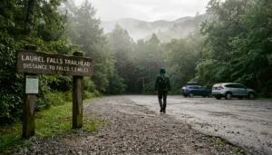
The Gatlinburg Trail has two trailheads: one at the Sugarlands Visitor Center on Newfound Gap Road (US 441) and one on River Road at the edge of downtown Gatlinburg, near traffic Light 10. Most hikers starting from outside the park begin at the Sugarlands end; hikers walking from town typically begin at the River Road end. Both options are valid, and many visitors treat the trail as a point-to-point walk with a ride or stroll back through downtown.
At the Sugarlands Visitor Center end, the trailhead is not immediately obvious. Walk behind the main visitor center building, past the restrooms, and past the brick headquarters building. The trail proper begins there as a wide, well-graded dirt path. GPS coordinates for this trailhead are 35.68579, -83.53677, per National Park Service data.
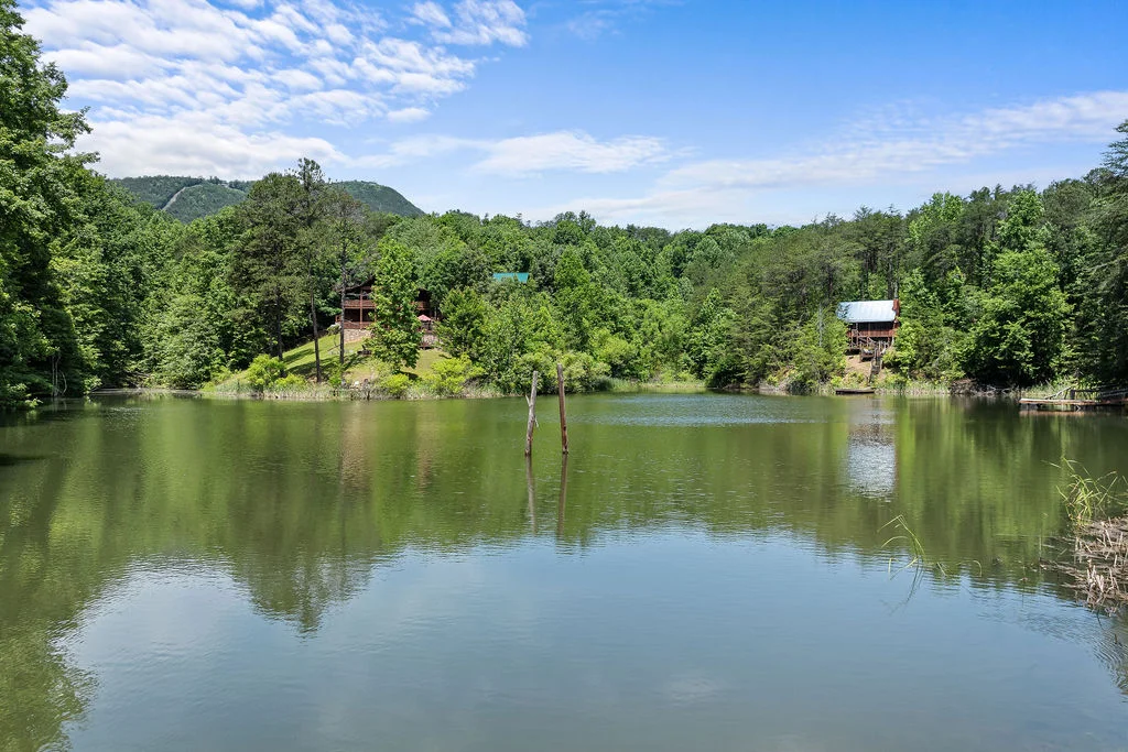
The River Road trailhead at the Gatlinburg end offers a different kind of entry. Small, free parking areas line River Road, and the route into the park from here feels immediately immersive: within a few steps you are in tree cover following the river. If you are staying in Gatlinburg, this is the more convenient starting point. The Spirit Bear, a 3-bedroom cabin located in Gatlinburg’s Arts and Crafts Community, sits roughly 0.6 miles from the Parkway and provides guests a quick jump to the River Road trailhead.
For the Sugarlands trailhead, follow signs for the visitor center on US 441. The parking lot here requires a paid parking tag for stays over 15 minutes. Paid parking is also available near the corner of US 441 and Ski Mountain Road if the visitor center lot is full on busy weekends.
Is Gatlinburg Trail Free?
Hiking the Gatlinburg Trail itself is free. Great Smoky Mountains National Park charges no general entrance fee, which makes it unusual among major national parks. However, parking is not free at the Sugarlands Visitor Center. A parking tag is required for any vehicle parked for more than 15 minutes anywhere in the park, including the Sugarlands lot. See the GSMNP parking tag information page for current pricing and how to purchase a tag in advance or on arrival.
Your free option: park along River Road near the Gatlinburg end of the trail. Small pullouts and designated parking areas on River Road fall just outside the formal park boundary and do not require a tag. Spaces fill by mid-morning on weekends from late spring through fall, so arrive before 9 AM if you want a free spot on a busy day.
For visitors who prefer to skip the parking question entirely, the Gatlinburg Trolley system connects downtown attractions to points near the park entrance seasonally. Check current schedules directly through the Gatlinburg Convention and Visitors Bureau, as routes and fares update annually.
How Long Does It Take to Hike the Gatlinburg Trail?
The Gatlinburg Trail takes most adults 1.5 to 2.5 hours to complete as an out-and-back hike, covering approximately 4 miles roundtrip. Families with young children or anyone who stops frequently to wade in the river, photograph wildlife, or explore the homestead ruins should budget closer to 3 hours. Solo hikers moving at a steady pace can complete it in 75 to 90 minutes.
The elevation profile is extremely gentle. Total roundtrip elevation gain is 235 feet, spread across roughly 4 miles, giving a per-mile gain of 121 feet. For reference, most visitors with no hiking experience handle this trail without discomfort. It is genuinely suitable for toddlers who can walk independently, older adults, and dogs of any fitness level.
The one-way option deserves consideration, especially for visitors staying in Gatlinburg. Walk from the River Road end to Sugarlands (or vice versa), spend 30 minutes exploring the visitor center, and then call a rideshare back. Total active hiking time drops to 50 to 75 minutes, and you avoid doubling back on the same scenery. The Gatlinburg Enchantment cabin in the Hemlock Hills Resort community sits just 1.8 miles from downtown Gatlinburg, making both the River Road trailhead and a post-hike Parkway lunch realistic on the same morning.
What Are the Key Landmarks Along the Gatlinburg Trail?
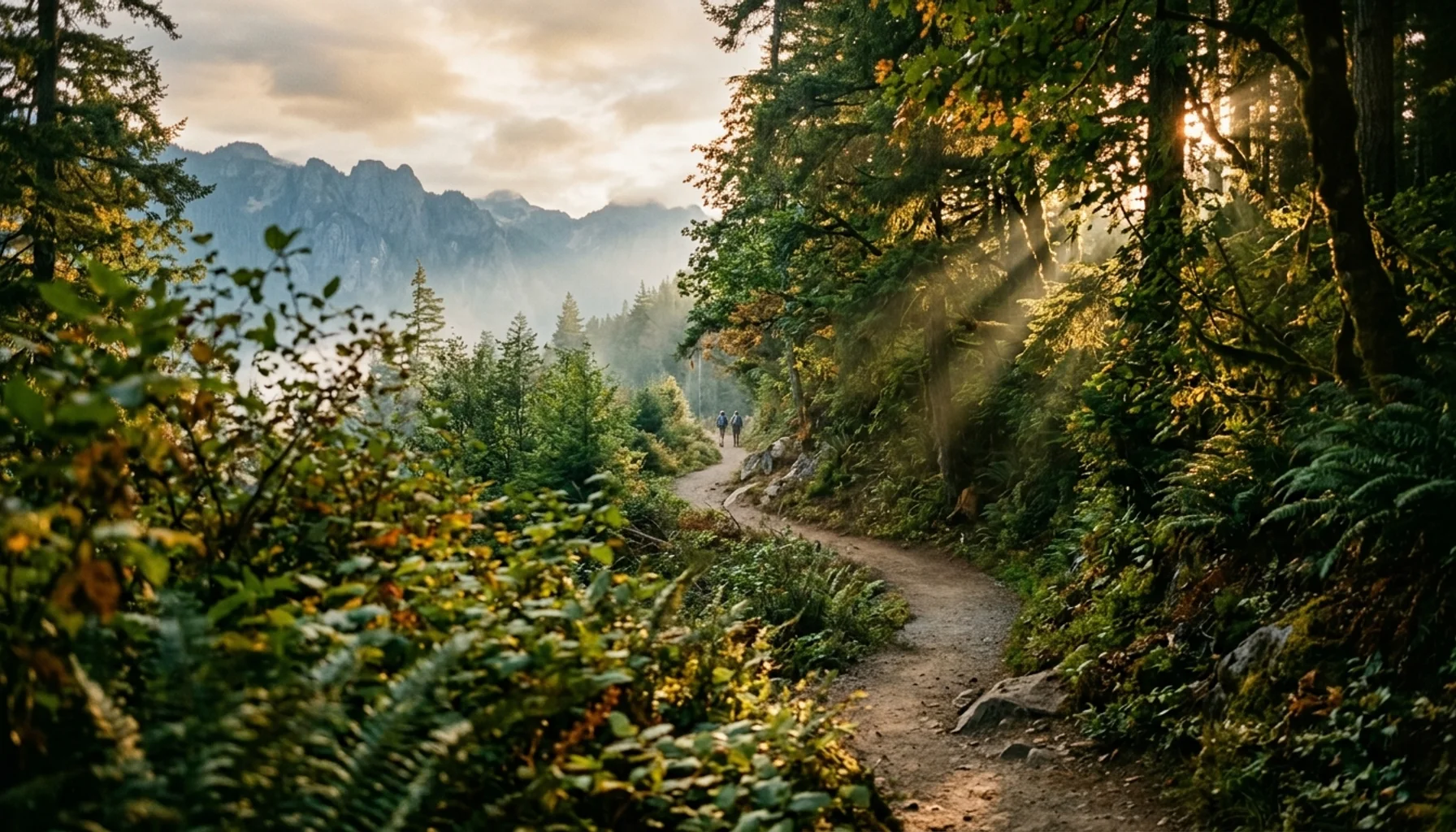
The Gatlinburg Trail follows a linear route with five landmarks worth watching for, each arriving in predictable order from the Gatlinburg end toward Sugarlands. Walking this route from town to visitor center, you encounter: the West Prong footbridge, the pre-park homestead ruins, the North District Maintenance Center, the Cataract Falls junction, and the Gatlinburg Bypass underpass before the trail widens toward the visitor center area.
At roughly 0.5 miles from the Gatlinburg trailhead, the trail crosses the West Prong of the Little Pigeon River via one of the longest footbridges in Great Smoky Mountains National Park. The river is accessible from many points before the bridge too, and the gravel bars along the bank are popular with children and dogs.
Shortly after the bridge, the trail climbs a short, gentle hill and passes the remnants of a homestead that predates the park’s establishment in 1934. A stone chimney and scattered rock foundation walls are visible from the trail. This is one of hundreds of historic structures absorbed into the park when the federal government acquired the land.
At roughly 1.2 miles, the trail passes the North District Maintenance Center, a cluster of park maintenance buildings. The trail narrows slightly here and routes along a service road before returning to the forested path.
At roughly 1.9 miles, a signed junction marks the side trail to Cataract Falls. This is the most commonly skipped landmark on the entire route, which is a mistake. See the Cataract Falls section below for full detail.
Near the 2-mile mark, the trail passes beneath the Gatlinburg Bypass overpass. Road noise is present here briefly, and the section between the bypass and the visitor center includes sidewalk and roadside walking before the route ends at the Sugarlands area. This is the least scenic stretch, but it is short.
What Is the Famous Trail in Gatlinburg, Tennessee?
The Gatlinburg Trail is the most accessible and beginner-friendly trail near the town of Gatlinburg, but the region has several famous hikes in Great Smoky Mountains National Park. Laurel Falls Trail, at approximately 2.6 miles roundtrip, leads to the park’s most visited waterfall and draws enormous crowds. Alum Cave Trail, at 4.4 miles roundtrip to the bluffs, is more strenuous but offers dramatic cliff formations and mountain views. Mount LeConte via various routes is the classic overnight backcountry experience in the park.
Among these, the Gatlinburg Trail earns its fame for a different reason: access and inclusivity. As the official NPS Gatlinburg Trail page confirms, this route and the Oconaluftee River Trail near Cherokee are the only two trails in the entire park where leashed pets and bicycles are permitted. That single fact draws thousands of visitors who would otherwise be unable to hike with their dogs inside park boundaries.
For visitors looking to contrast their Gatlinburg Trail experience with a more demanding option, the Porters Creek Trail offers moderate difficulty with historic interest, and Rocky Top and Thunderhead Mountain remains the iconic difficult summit for experienced hikers. Both are accessible from different trailheads in the park, not from downtown Gatlinburg.
Is the Cataract Falls Detour Worth It?
The Cataract Falls side trail is a 0.5-mile spur off the Gatlinburg Trail at approximately 1.9 miles from the Gatlinburg end, and it is absolutely worth the detour. The falls drop into a rocky pool in a narrow, forested hollow, and the sound of the water is audible well before you see the cascade. Most visitors who reach this signed junction and turn back without exploring it later regret the decision when they see photos.
The side trail to Cataract Falls gains elevation more noticeably than the main Gatlinburg Trail, but the distance is short enough that it adds only 15 to 20 minutes to your total hiking time. The path is dirt and rock, with some root exposure. Sturdy sneakers handle it fine; sandals are a risk on wet days.
At the falls, the cascade drops over a series of mossy rock shelves surrounded by hemlock and rhododendron. The pool at the base is not deep enough for swimming but provides an excellent rest stop. On summer weekday mornings, you may have the spot largely to yourself. On fall weekends, expect company.
One honest caveat: the trail surface to the falls is not maintained to ADA standards and is not suitable for strollers or GRIT Freedom Chairs. If accessibility is a priority, enjoy the main Gatlinburg Trail and skip this spur. The main trail itself has been assessed using the High-Efficiency Trail Assessment Process (HETAP) by the National Park Service for objective accessibility data, and GRIT Freedom Chairs are available for free checkout at Sugarlands on a first-come, first-served basis per the Great Smoky Mountains trail accessibility page.
What Should You Know About the 2016 Wildfire History?
The Gatlinburg Trail passes through territory directly affected by the Chimney Tops 2 wildfire of November 2016, and visible burn scars remain along portions of the route as of 2026. Understanding that history adds real depth to what you observe walking through sections where forest regeneration is still underway alongside mature, unaffected hardwood canopy.
On November 23, 2016, two juveniles ignited a fire near the Chimney Tops summit. Wind gusts exceeding 80 mph during a period of exceptional drought drove the fire beyond the park boundary and into Gatlinburg on November 28. The wildfire burned almost 18,000 acres total, including 11,410 acres within Great Smoky Mountains National Park. The fire killed 14 people, injured more than 176, damaged or destroyed at least 2,460 structures, and caused more than $500 million in damage.
The burn patterns along the Gatlinburg Trail are instructive: some stands of trees were left nearly untouched while adjacent slopes show regrowth vegetation typical of post-fire recovery. Tulip poplar, serviceberry, and fire cherry are among the early colonizers visible in burn areas. Ten years on, the forest is healing, but the scars remain legible if you know what you are looking at.
The Gatlinburg Trail hike guide with elevation profile and map from hikinginthesmokys.com provides good additional historical context and mile-by-mile landmark descriptions for anyone who wants a detailed reference beyond the NPS overview.
When Is the Best Time to Hike the Gatlinburg Trail?
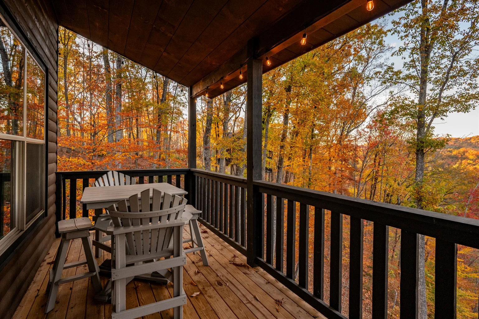
The Gatlinburg Trail is hikeable year-round, but each season offers genuinely different conditions. Spring brings the most spectacular wildflower display, with trilliums, wild geranium, and bloodroot blooming in the cove hardwood forest from late March through May. Fall foliage peaks at lower elevations in Gatlinburg typically between mid-October and early November. Summer offers the fullest canopy and the most river access but also the largest crowds. Winter brings solitude, possible ice on the trail surface near the river, and exceptional clarity through the bare-branched forest.
Best time for wildflowers: Late March through mid-May. The cove hardwood forest along the West Prong is one of the most wildflower-dense habitats in the park at this time of year.
Best time for fall foliage: Mid-October through early November at the lower Gatlinburg elevation. The color comes to the ridge tops first and works downward, so the trail’s river corridor is at peak color slightly later than the park’s higher elevations.
Worst time for crowds: Summer weekends, especially July 4th week and mid-August. The Sugarlands parking lot fills by 9 AM on peak days, and the River Road pullouts go shortly after. Arriving before 8 AM or after 4 PM on summer weekends dramatically improves your experience.
Winter conditions: The trail is not closed in winter, but sections near the river can ice over after rain or overnight freezes. Traction devices are worth packing December through February. The reward is a nearly empty trail with views through the bare canopy that summer hikers never see.
Sevier County tourism has grown consistently year over year, and 2026 continues that trend. According to the Tennessee Department of Tourist Development, Tennessee welcomed 147 million visitors in 2026, making crowd awareness increasingly practical planning information rather than optional advice.
What Should You Pack for the Gatlinburg Trail?
The Gatlinburg Trail is short and easy enough that many visitors complete it with minimal preparation. That said, a few specific items meaningfully improve the experience and reduce the small risks present on any forest path.
Footwear: Trail runners or hiking shoes with light grip are the right call. The trail surface combines paved sections, crushed stone, dirt, exposed roots, and uneven rock near the river. Flip-flops and dress shoes are not appropriate, particularly in wet conditions or if you plan the Cataract Falls spur. Sandals designed for hiking work fine on dry days if you have good ankle stability.
Water: Carry at least 16 ounces per person for an out-and-back hike at a casual pace. In summer, 32 ounces per person is more appropriate. Do not drink directly from the river; filtration or purification is required even for clear mountain water.
Dog supplies: Leash (required by park rules), collapsible bowl, and water for your dog specifically. Tick prevention applied before the hike is strongly advised, as the trail runs through cove hardwood habitat where ticks are active spring through fall. The Oconaluftee River Trail near Cherokee is the only other dog-permitted trail in the park if you need an alternative on a return visit.
For families with strollers: The main Gatlinburg Trail is manageable with a jogging stroller or a sturdy all-terrain model on the dirt sections, but it is not ADA accessible and not suitable for standard umbrella strollers on the root-covered and uneven portions. The paved sections near both trailheads are fully stroller-friendly. If accessibility is the priority, the GRIT Freedom Chair program at Sugarlands Visitor Center provides adaptive mobility equipment at no charge, though availability is first-come, first-served. Confirm availability at the visitor center before planning your trip around this option.
Sun protection: The cove hardwood canopy provides excellent shade in summer, but the sections near the Gatlinburg Bypass and along the roadside approach to Sugarlands are exposed. Sunscreen and a hat are worth packing even on cloudy days in summer.
For hiking safety guidelines that apply to all trails in the park, the official NPS hiking safety page covers bear safety, stream crossing protocols, and weather awareness in detail.
How Do You Combine the Gatlinburg Trail with a Town Visit?
The Gatlinburg Trail is uniquely positioned among park hikes because it begins at the edge of a walkable town, making a combined trail-and-town morning genuinely easy to plan. The practical approach: park on River Road near the Gatlinburg trailhead, hike the trail out-and-back or one-way to Sugarlands, and then spend the afternoon on Gatlinburg’s Parkway before your cabin’s evening starts.
From the River Road trailhead, you are a short walk from the Parkway’s main corridor. The Gatlinburg SkyLift and SkyBridge, Anakeesta Adventure Park, and Ripley’s Aquarium of the Smokies are all within roughly 1.5 miles of the River Road trailhead. None of these require advance planning for entry, though Anakeesta is worth booking online during peak season to avoid a wait.
For lunch or dinner after the hike, the River Road area connects to downtown restaurants without requiring a car move. The Old Mill area in nearby Pigeon Forge, accessible by a short drive, offers the kind of Southern comfort food that works well after a morning hike. The Old Mill Restaurant is a genuine regional institution with stone-ground grits and buckwheat pancakes that have made it a repeat destination for multi-generational family groups for decades.
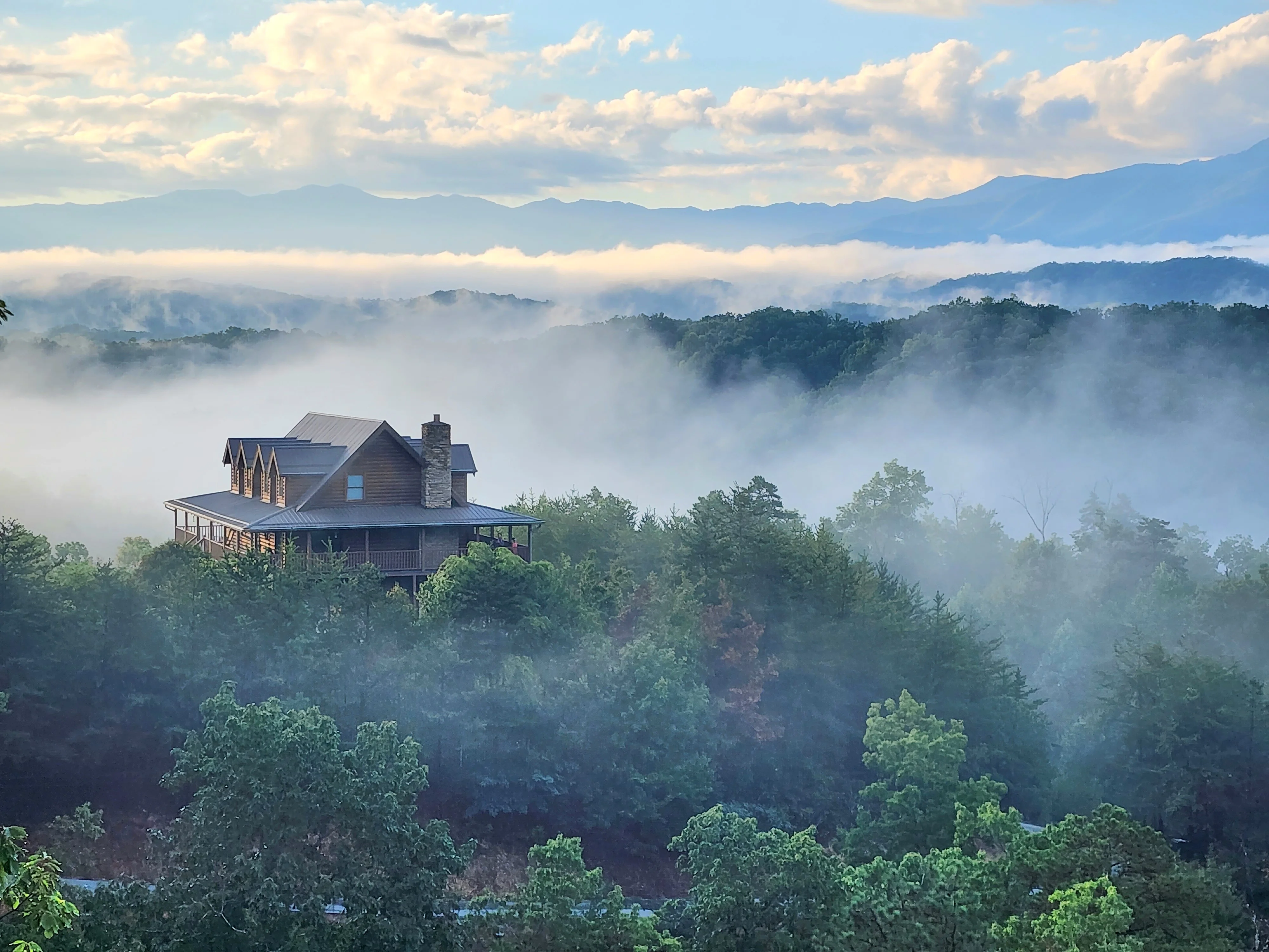
Visitors staying at Chase N Moose, a 2-bedroom cabin in Cobbly Nob Resort just 2 miles from downtown Gatlinburg, have the most direct access to this combined itinerary. The cabin’s proximity puts the River Road trailhead under 5 minutes by car, and the Parkway attractions are the same distance in the other direction. For groups wanting a more spacious base with the same Gatlinburg access, Mountain View Manor in Chalet Village sits 1.5 miles from the Parkway and less than 5 minutes from the park entrance, with 3,800 square feet and panoramic mountain views to return to after a day on the trail.
Wildlife and Flora: What Will You Actually See?
The Gatlinburg Trail passes through a cove hardwood forest, one of the most biodiverse forest types in eastern North America. The plant community along the West Prong corridor includes tulip poplar, white oak, eastern hemlock, and a dense understory of rhododendron, dog hobble, and mountain laurel. In spring, the trail floor lights up with trillium, Dutchman’s breeches, hepatica, and jack-in-the-pulpit before the canopy closes overhead and shades out the wildflower layer.
Wildlife is genuinely present along this trail, not just theoretically. White-tailed deer are commonly seen in the early morning near the river corridor. Eastern box turtles cross the trail in summer. The West Prong supports native brook trout visible in clear pool sections. Black bears are residents of the Sugarlands area, and while sightings are not guaranteed, they are more common here than on many park trails because of the trail’s proximity to the park boundary. Bears do not pose a threat to hikers who follow standard protocols: never approach, never feed, secure all food and trash. The NPS provides bear safety guidance at the visitor center.
Bird watchers will find the cove hardwood habitat productive. Louisiana waterthrushes nest along the river and are vocal from March through July. Ovenbirds, wood thrushes, and scarlet tanagers use the forest interior. In winter, the bare canopy makes it easier to spot golden-crowned kinglets and yellow-rumped warblers moving through the riverside trees.
Step-by-Step: How to Plan Your Gatlinburg Trail Day
Planning a Gatlinburg Trail day takes under 10 minutes if you follow a clear sequence. Here is the practical framework from start to finish.
- Choose your trailhead. River Road (Gatlinburg end) for free parking and a town combination. Sugarlands Visitor Center for the official park experience and visitor center access. Most first-timers prefer the River Road start for convenience.
- Purchase your parking tag if using Sugarlands. Visit the GSMNP parking tag information page before arrival to buy online. Tags can also be purchased on-site at fee stations, but lines form on busy weekends. The parking tag is a per-vehicle daily activity fee; the trail itself has no entry charge.
- Time your arrival. Arrive at River Road before 9 AM on summer and fall weekends to secure free parking. Sugarlands lot fills later but still peaks by 10 AM on busy days. Weekday mornings offer the most relaxed experience year-round.
- Bring the essentials. Water (at least 16 oz per adult), appropriate footwear, a leash for dogs, and tick protection applied before leaving your cabin. Sunscreen for the exposed sections near the road and bypass.
- Walk the route. From the Gatlinburg end: river access and gravel bars from the start, footbridge at 0.5 miles, homestead ruins shortly after, maintenance center at 1.2 miles, Cataract Falls junction at 1.9 miles (take the spur), Gatlinburg Bypass underpass, trail widens toward Sugarlands. Turn back or continue to visitor center.
- Take the Cataract Falls spur. At the signed junction at 1.9 miles, turn onto the spur and walk 0.5 miles to the falls. Add 15 to 20 minutes total. Worth it unconditionally on your first visit.
- Plan the post-hike. From River Road, walk to Parkway attractions or drive to a restaurant. From Sugarlands, browse the visitor center exhibits on park history and wildlife before heading back.
Common mistake to avoid: Treating this as a purely utilitarian out-and-back and rushing through. The homestead ruins and the footbridge over the West Prong are the trail’s most photogenic moments. Slow down at those two spots specifically. The rushing stretch between the maintenance center and the bypass is the one section where a steady pace makes sense.
For visitors planning a broader Smoky Mountains trip, the Smoky Mountain Vacation Planner from Hemlock Hills Cabin Rentals covers additional logistics for multi-day itineraries across Gatlinburg, Pigeon Forge, and Sevierville.
Frequently Asked Questions About the Gatlinburg Trail
How long does it take to hike the Gatlinburg Trail?
Most adults complete the Gatlinburg Trail as an out-and-back hike in 1.5 to 2.5 hours, covering approximately 4 miles roundtrip. Families with young children or anyone planning the Cataract Falls spur should budget 3 hours. Solo hikers at a steady pace can finish in 75 to 90 minutes. The total elevation gain of only 235 feet means the pace-limiting factor is usually scenery stops, not physical effort.
Where does the Gatlinburg Trail start?
The Gatlinburg Trail has two trailheads. The first is at the Sugarlands Visitor Center on Newfound Gap Road (US 441), with GPS coordinates 35.68579, -83.53677. Walk behind the visitor center building, past the restrooms and brick headquarters building, to reach the trailhead. The second is on River Road near downtown Gatlinburg, close to traffic Light 10. Free parking is available along River Road; paid parking tags are required at the Sugarlands lot.
Is the Gatlinburg Trail free?
Hiking the Gatlinburg Trail is free. Great Smoky Mountains National Park has no general entrance fee. However, parking at the Sugarlands Visitor Center requires a paid parking tag for stays over 15 minutes. Free parking is available in small pullouts along River Road at the Gatlinburg end of the trail, though those spaces fill quickly on summer and fall weekends. Purchase parking tags in advance at the GSMNP parking tag information page to avoid on-site wait times.
Can I bring my dog on the Gatlinburg Trail?
Yes. The Gatlinburg Trail is one of only two trails in all of Great Smoky Mountains National Park where leashed pets are permitted, the other being the Oconaluftee River Trail near Cherokee. Dogs must remain on a leash no longer than 6 feet at all times. Apply tick prevention before the hike, bring water for your dog, and be aware that the Cataract Falls spur has uneven terrain that requires confident footing for larger dogs.
What is the famous trail in Gatlinburg, Tennessee?
The Gatlinburg Trail is the best-known accessible trail near the town, but several park trails have regional fame. Laurel Falls Trail leads to the park’s most-visited waterfall. Alum Cave Trail reaches dramatic cliff formations at a moderate difficulty. The Gatlinburg Trail stands out specifically because it is one of only two dog- and bike-friendly trails in the park and connects directly to downtown Gatlinburg, making it uniquely usable for visitors who cannot or prefer not to hike deep backcountry routes.
Is the Cataract Falls detour worth taking?
Yes, unconditionally on a first visit. The Cataract Falls spur branches off the Gatlinburg Trail at roughly 1.9 miles from the Gatlinburg trailhead and reaches a cascading waterfall in approximately 0.5 miles. The side trail gains more elevation than the main route but the distance is short, adding only 15 to 20 minutes total. The falls drop into a rocky pool in a hemlock-and-rhododendron hollow. The main caveat: this spur is not stroller-friendly or suitable for GRIT Freedom Chairs.
Are bikes allowed on the Gatlinburg Trail?
Yes, bicycles are permitted on the Gatlinburg Trail, making it one of only two trails in Great Smoky Mountains National Park where both bikes and pets are allowed. The trail surface includes paved sections, crushed stone, roots, and uneven dirt, so a mountain bike or hybrid with wider tires handles the route better than a road bike. Sections near the river and the Cataract Falls junction require dismounting or careful navigation.
What wildlife might I see on the Gatlinburg Trail?
The Gatlinburg Trail runs through cove hardwood forest along the West Prong of the Little Pigeon River, one of the most biodiverse habitats in eastern North America. White-tailed deer are frequently seen near the river in the early morning. Brook trout are visible in clear pool sections of the river. Black bears are residents of the Sugarlands area; sightings are possible but not guaranteed. Louisiana waterthrushes and wood thrushes are vocal along the river corridor from spring through summer. Tick awareness is essential spring through fall in this habitat.
Ready to Hike the Gatlinburg Trail? Plan Your Stay Nearby
The Gatlinburg Trail covers real ground: 4 miles of riverside forest, a historic homestead, one of the park’s longest footbridges, a worthwhile waterfall detour, and the lingering story of a wildfire that reshaped the region. In 2026, it remains the most accessible, most dog-friendly, and most practically useful hike for visitors who want a genuine park experience without a full-day backcountry commitment.
The key decisions are simple. Arrive early, especially on fall and summer weekends. Start from River Road if you want free parking and a town combination. Take the Cataract Falls spur at 1.9 miles. Bring water for both yourself and your dog. And check the GSMNP parking tag information page before you go if you plan to park at Sugarlands.
Whether this is your first Smoky Mountains trip or your tenth, the Gatlinburg Trail delivers something worth returning to in every season. Spring trilliums, fall foliage, a winter canopy that opens to the ridgeline, and summer mornings when the river is cold and the forest is full. Few trails in the park offer that range.
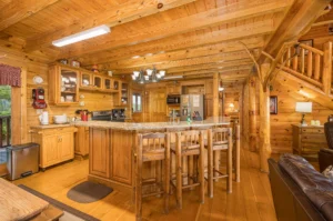
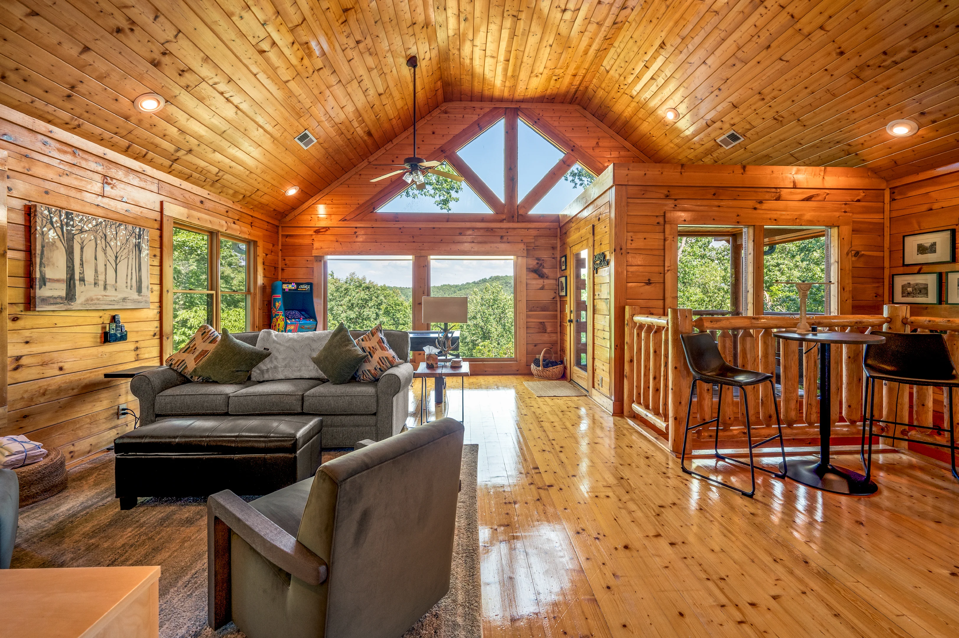
If you are planning a hiking trip centered on the Gatlinburg Trail, The Spirit Bear puts you 0.6 miles from the Parkway and under 5 minutes from both the River Road trailhead and downtown Gatlinburg. Three king suites, a covered hot tub, and a fire pit handle the recovery portion of the day with equal competence. Check availability and dates here.
For families or larger groups wanting more space along with the same Gatlinburg access, browse the full selection of Gatlinburg cabins from Hemlock Hills Cabin Rentals to find a property that fits your group’s size and priorities.