
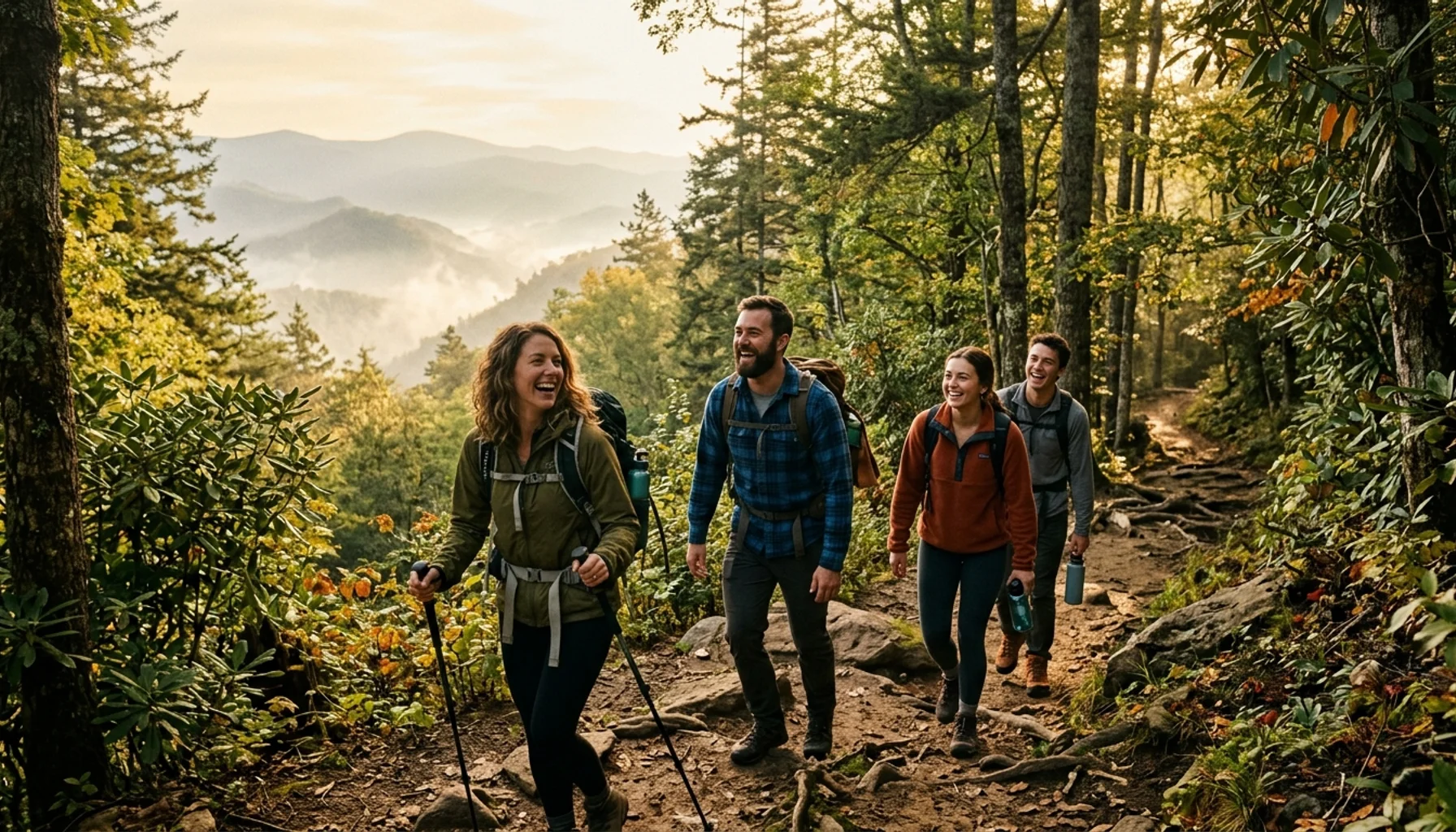
Great Smoky Mountains National Park contains more than 800 miles of hiking trails, spanning the Tennessee-North Carolina border and ranging from paved half-mile loops to strenuous 14-mile ridge climbs. Whether you want to see a 90-foot waterfall, reach the summit of Mount LeConte, or walk through a wildflower meadow at sunrise, the park has a trail for your ability level and schedule.
- Great Smoky Mountains National Park has over 800 miles of trails and 71 miles of the Appalachian Trail within its boundaries, according to the National Park Service.
- No permit is required for day hikes; a free backcountry permit is required for overnight trips and can be obtained through the park’s reservation system.
- The most popular trailheads (Alum Cave, Chimney Tops, Abrams Falls) fill by 9 AM on summer weekends; arrive before 8 AM or visit on a weekday.
- Alum Cave Trail to Mount LeConte is 11 miles roundtrip and is the shortest route to the summit; LeConte Lodge reservations must be made months in advance.
- Several paved or nearly flat trails, including Sugarlands Valley Nature Trail and the Gatlinburg Trail, are accessible for visitors with limited mobility or young children.
- Guests staying at The Spirit Bear in Gatlinburg are roughly 5 minutes from the Great Smoky Mountains National Park entrance, making early trailhead starts easy.
What Is the TL;DR on Great Smoky Mountains Hiking?
The quick version: the Smokies offer everything from a 1.3-mile stroll to Grotto Falls to a 13.9-mile summit push on Rocky Top. Most trails are out-and-back. Day hiking requires no permit. Trailhead parking fills fast on summer and fall weekends. The best strategy is to start early, pick your trail by fitness level rather than name recognition, and check the NPS official hiking page for current closures before you leave your cabin.
- Best easy hike: Spruce Flat Falls (2 miles roundtrip, 30-foot waterfall, light crowds)
- Best moderate hike: Abrams Falls (5.2 miles roundtrip, 675 feet elevation gain)
- Best strenuous hike: Rocky Top via Appalachian Trail (13.9 miles, 3,655 feet elevation gain)
- Best family hike: Andrews Bald (3.5 miles roundtrip from Clingmans Dome parking, open-air meadow views)
- No day-hike permit needed; backcountry permit required for overnight stays
How Many Trails Does Great Smoky Mountains National Park Have?
Great Smoky Mountains National Park contains more than 800 miles of maintained hiking trails, including 71 miles of the Appalachian Trail that runs along the park’s main ridge. The trail network covers the Tennessee and North Carolina sides of the park, connecting valleys, waterfalls, open balds, and high-elevation summits. Most trails are out-and-back in design; true loop hikes are rare within the park boundaries.
The park was designated a UNESCO World Heritage Site in 1983 and holds more than 1,500 species of flowering plants. That biodiversity makes even the shorter trails rewarding at different times of year: spring brings trillium carpets on Porters Creek Trail, summer fills the canopy with old-growth tulip trees along Ramsey Cascades, and fall turns the ridges brilliant orange and red. Winter thins the crowds dramatically, though several high-elevation roads and some upper trails close from late November through March.
For an overview of the full trail system, the Great Smoky Mountains Visitor Centers distribute free paper trail maps and post current closure information at each entrance. Downloading the official NPS app before your trip gives you offline trail maps, which matters in the park’s limited-signal areas.
What Are the Best Hiking Trails in the Smokies by Difficulty?
The best Great Smoky Mountains National Park hiking trails vary by fitness level, but every category has standout options. Easy trails cover 2-4 miles roundtrip with under 500 feet of elevation gain. Moderate trails run 5-8 miles with up to 1,500 feet of gain. Strenuous trails typically exceed 8 miles and climb more than 2,000 feet. Choosing by difficulty first, then by scenery type, produces the most satisfying result for most hikers.
Easy Trails Worth Your Time
Spruce Flat Falls is 2 miles roundtrip with a 30-foot waterfall at the end and almost no crowds compared to the park’s famous falls. The trailhead sits across from the Tremont Visitors Center. This is one of the park’s genuine hidden trails in the sense that it rarely appears in top-10 lists, yet delivers a genuine payoff.
Andrews Bald is 3.5 miles roundtrip from the Clingmans Dome parking area with 899 feet of elevation gain. The open meadow at the top offers sweeping views without requiring technical skill. One catch: Clingmans Dome Road closes in winter, typically from late November through late March. If you visit during that window, Andrews Bald becomes a 10-mile one-way hike via the Appalachian Trail, which is firmly in strenuous territory.
Gatlinburg Trail and Sugarlands Valley Nature Trail are the park’s most accessible options for families with strollers, older visitors, or anyone with mobility limitations. Both are nearly flat, paved or hard-packed, and located near the Sugarlands Visitor Center entrance.
Moderate Trails With Serious Scenery
Abrams Falls is 5.2 miles roundtrip with 675 feet of elevation gain, located in Cades Cove. The trail involves stream crossings and some rocky sections, but the 20-foot-wide falls at the end justify the effort. Start before 9 AM on weekends; the Cades Cove Loop Road itself can add 30-60 minutes of driving time on busy mornings.
Charlies Bunion runs 8.1 to 9.5 miles roundtrip depending on your starting point and whether you add The Jump-Off. The hike departs from Newfound Gap and follows the Appalachian Trail. The exposed rock face you reach at the end was created roughly 100 years ago when a combination of wildfire and flooding stripped the vegetation and soil from the side of the ridge. The views are worth every step. For a combined Charlies Bunion and Jump-Off experience, plan for the longer mileage; The Jump-Off Trail Guide from RootsRated covers the combination route in detail.
Porters Creek Trail is 4 miles roundtrip with 699 feet of elevation gain. It is one of the best spring wildflower hikes in the entire park: trillium carpets the forest floor in April and early May. The trail also passes the Elbert Cantrell farmstead stone walls, Ownby Cemetery, and a cabin built by the Smoky Mountain Hiking Club in the mid-1930s. See the Porters Creek Trail Guide at HikingInTheSmokys for photos and a full elevation profile.
Strenuous Trails for Experienced Hikers
Rocky Top and Thunderhead Mountain is 13.9 miles roundtrip with 3,655 feet of elevation gain, following the Appalachian Trail to the summit. This is the hardest widely-hiked trail in the park and is not suitable for beginners regardless of how much they want the bragging rights. Allow a full day and bring trekking poles. The Rocky Top and Thunderhead Mountain trail guide includes detailed maps and photo documentation of current conditions.
Mount LeConte via Alum Cave Trail is 11 miles roundtrip with 2,763 feet of elevation gain. Alum Cave is described by most sources as the shortest, steepest, and most popular route to the summit. Along the way you pass Arch Rock, Inspiration Point, and the 80-foot Alum Cave Bluff before the final push to the top. Six total routes reach LeConte’s summit; Alum Cave is the best combination of efficiency and scenery. The full Mount LeConte trail guide from RootsRated compares all six approaches.
Gregory Bald is 11.3 miles roundtrip with 2,300 feet of elevation gain. The panoramic views from the open grassy summit are among the best in the park. Ranked as the top hike by HikingInTheSmokys.com, it is often overlooked by visitors who default to the more-marketed LeConte or Chimney Tops hikes.
Mt. Cammerer is 11.1 miles roundtrip with 3,045 feet of elevation gain, accessible from the Cosby Campground or Big Creek trailheads. The historic stone lookout tower at the summit offers 360-degree panoramic views that rival any viewpoint in the park. For overnight trip planning, the Mount Cammerer views and backcountry camping guide from RootsRated is the most comprehensive resource available.
Do You Need a Permit for Hiking in Great Smoky Mountains National Park?
Great Smoky Mountains National Park requires no permit and charges no entrance fee for day hiking, which makes it one of the most accessible major national parks in the United States. However, overnight backcountry camping requires a free backcountry permit, which must be reserved through the park’s online reservation system before your trip. Staying at LeConte Lodge on the Mount LeConte summit requires a separate reservation that should be made months in advance.
For day hikers, the practical barrier is not permits but parking. The most popular trailheads, including Alum Cave Trail, Chimney Tops, and the Abrams Falls lot in Cades Cove, fill to capacity by 9 AM on summer and fall weekends. When a trailhead lot fills, rangers close the road access, and you cannot simply wait nearby. The solution is straightforward: arrive before 8 AM, visit on a weekday, or choose a lesser-known trailhead for the same scenic payoff. Spruce Flat Falls and Brushy Mountain via Trillium Gap Trail are two examples of alternatives that rarely have parking issues.
The park’s mailing address and main information line (107 Park Headquarters Road, Gatlinburg, TN 37738; phone 865-436-1200) can confirm current backcountry permit availability and trail conditions before you drive out. Always check real-time closures on the official NPS site; high-water events, storm damage, and wildlife activity can close trails with little advance notice.
When Is the Best Time to Hike the Smokies, and Which Trails Close in Winter?
The best time to hike Great Smoky Mountains National Park depends on what you want to see. Spring (mid-March through May) brings peak wildflower displays, especially on Porters Creek Trail and in Cades Cove. Summer offers full-canopy green scenery and consistent weather but also the highest crowds and afternoon thunderstorm risk at elevation. Fall foliage typically peaks at high elevations in early October and at lower elevations by late October. Winter provides the least-crowded conditions, but specific closures apply.
Trail and Road Closures by Season
Clingmans Dome Road closes to vehicles from late November through late March, which directly affects Andrews Bald. The bald is a pleasant 3.5-mile roundtrip hike when the road is open; it becomes a 20-plus mile undertaking when the road is closed.
High-elevation trails above 5,000 feet can accumulate ice and snow from November through April. Rocky Top, Mt. Cammerer, Charlies Bunion, and the upper Alum Cave Trail all require traction devices (microspikes or crampons) during this period. Attempting these in sneakers after a cold front is one of the most common reasons for search-and-rescue calls in the park.
Cades Cove Loop Road is gated on Wednesdays and Saturdays mornings until 10 AM for pedestrian and cyclist use only, which is actually the best time to experience it without vehicle traffic.
For a current breakdown of what is open, the park provides a real-time trail and road closure list on the NPS website. Checking this the morning of your hike is worth the two minutes it takes, particularly in spring when high-water events regularly close stream-crossing trails like Abrams Falls.
Crowd Strategy by Trail
The single most effective crowd-avoidance strategy in 2026 is choosing a Tuesday, Wednesday, or Thursday visit over any weekend day. Gatlinburg-area visitation patterns mean Saturday trails near the main entrance can see three to four times the foot traffic of a midweek morning. If your schedule is fixed to a weekend, the trails on the North Carolina side of the park (Ramsay Cascades, Mt. Cammerer via Big Creek) consistently see lower Tennessee-side trailhead congestion because fewer visitors make the longer drive.
What Should You Know Before Hiking in the Smokies? Safety and Preparation
Hiking safely in Great Smoky Mountains National Park requires understanding four specific risks: wildlife encounters, stream crossings, afternoon storms at elevation, and the park’s deceptively strenuous terrain. Every year, hikers underestimate trail difficulty because the roundtrip distances sound short. A 5-mile hike with 2,000 feet of elevation gain takes most people twice as long as a 5-mile flat trail.
Wildlife and Bear Country
The Smokies support a healthy black bear population. Every trailhead posts bear safety reminders, and the park service recommends keeping food in bear-proof containers or in your vehicle (not your tent). Make noise on the trail, especially around blind curves and near streams where the water sound masks your approach. Bear encounters are common but attacks are rare when proper food-storage and distance protocols are followed.
Beyond bears, the park has wild boar, venomous timber rattlesnakes (primarily on lower-elevation trails during warmer months), and elk in the Cataloochee Valley area on the North Carolina side. None of these pose a significant risk to hikers who stay on trail and observe wildlife from a distance.
Stream Crossings and Water
Several moderate-to-strenuous trails require stepping-stone or shallow ford crossings. Abrams Falls involves multiple crossings that are manageable in dry conditions but can become dangerous after heavy rain. Never attempt a knee-deep or faster-moving crossing; the park closes these trails for a reason when water levels rise. The official NPS hiking safety guidelines cover stream crossings in detail and are worth reading before any trail that follows a creek corridor.
Physical Fitness and Elevation
The park’s highest trails reach over 6,000 feet. Most visitors arrive from lower elevations and may notice fatigue more quickly at altitude. Pace yourself on the first mile of any strenuous hike rather than going out hard and bonking at the turnaround point. Trekking poles reduce knee stress on steep descents by roughly 25%, according to sports medicine guidelines, and are worth the investment if you plan multiple strenuous hikes in a week.
Who should consult a doctor before strenuous Smokies hikes: Anyone with a recent cardiac procedure, severe asthma, or significant joint replacements should discuss a high-elevation hike with their physician before attempting trails like Rocky Top or the upper sections of Alum Cave. The park’s strenuous trails are genuinely demanding, not just labeled cautiously.
Afternoon Thunderstorms
The Smokies receive some of the highest annual rainfall of any area east of the Rockies. Afternoon thunderstorms are common from May through September, and the exposed ridge trails (Rocky Top, Charlies Bunion, Gregory Bald) are dangerous in lightning. The standard rule is to leave exposed summits by 2 PM. Check the weather forecast the morning of your hike and plan your turnaround time accordingly.
What Are the Best Hiking Trails for Families and Kids in Great Smoky Mountains?
The best family hiking trails in Great Smoky Mountains National Park share three characteristics: short roundtrip distances under 4 miles, minimal elevation gain, and a clear payoff at the end (a waterfall, an open meadow, or a historic site) that gives children a goal to hike toward. The park has several strong options in this category that most online guides undercover because they focus on strenuous peak hikes instead.
Grotto Falls Trail is 2.6 miles roundtrip with 530 feet of elevation gain, located along Roaring Fork Motor Nature Trail. It is one of the only trails in the park where you can walk behind the waterfall. The path follows a creek the entire way, which keeps children engaged. Allow 2 hours roundtrip for a family with young children.
Sugarlands Valley Nature Trail is a 0.5-mile paved loop near the Sugarlands Visitor Center. It is completely flat and suitable for wheelchairs and strollers. This is the right starting point for families with toddlers or visitors who are new to hiking altogether.
Laurel Falls Trail is 2.6 miles roundtrip to the most-visited waterfall in the park. The trail is paved, which makes it accessible, but it is uphill both ways with moderate incline. The falls themselves split into upper and lower sections with a bridge crossing between them. Arrive before 9 AM on weekends; the small parking area fills by mid-morning.
Families staying near Gatlinburg should note that The Spirit Bear cabin sits roughly 5 minutes from the park entrance and about 15 minutes from the Laurel Falls trailhead, making it easy to get an early start before the parking areas fill. For families who want a cabin closer to Pigeon Forge, Pigeon Forge cabin rentals from Hemlock Hills put you within a 10-20 minute drive of the Sugarlands Visitor Center entrance.
How Do You Deal With Parking at Popular Trailheads?
Trailhead parking in Great Smoky Mountains National Park is the single most underestimated logistical challenge for first-time visitors. The park receives millions of visitors annually, and the most popular trailheads have parking lots that hold 30-80 vehicles. On peak summer and fall weekends, these lots fill by 9 AM, and rangers close road access when capacity is reached. There is no overflow waiting area; you are redirected out of the park.
Specific Trailhead Parking Notes
Alum Cave Trailhead: One of the most sought-after lots in the park. Arrive by 8 AM on weekends between June and October. Weekday mornings are manageable with a 9-10 AM arrival.
Chimney Tops Trailhead: Fills by 9 AM on almost every weekend. The trail itself was renovated through the Great Smokies Trails Forever Program after flood and storm damage, and it remains extremely popular.
Cades Cove / Abrams Falls: The drive around Cades Cove Loop Road takes 1-2 hours on busy days before you even reach the Abrams Falls trailhead. Budget accordingly. The early-Wednesday and early-Saturday pedestrian-only window (before 10 AM) offers a rare chance to drive in quickly after 10 AM once the gate opens.
Practical alternatives: The park does not currently operate a widespread shuttle system to major trailheads, though the Gatlinburg Trolley does provide limited service near the main park entrance for a small fare. If you are staying in Gatlinburg, the trolley is worth checking before driving; parking in Gatlinburg itself and using the trolley to reach the Sugarlands area avoids the trailhead lot problem entirely for certain hikes.
Guests at A Southern Point of View in the Cobbly Nob resort area have the Cataract Falls Trail within a 5-minute walk from the cabin door, which eliminates the trailhead parking challenge for that particular hike entirely.

What Are the Historic and Cultural Highlights on Smoky Mountains Trails?
Great Smoky Mountains National Park trails are unique among major national parks for preserving 19th and early 20th century Appalachian settlement history alongside the natural scenery. Several trails pass working farmsteads, stone walls, cemeteries, and log structures that pre-date the park’s establishment, giving hiking a historical dimension that purely scenic parks cannot offer.
Porters Creek Trail is the best single trail for cultural history. The 4-mile route passes the Elbert Cantrell farmstead stone walls, Ownby Cemetery, and the John Messner farm site, all of which date to the early 20th century. A cabin built by the Smoky Mountain Hiking Club in the mid-1930s still stands near the trail. Spring visitors get the wildflower payoff on top of the history lesson.
Cades Cove contains the John Oliver Cabin, built around 1820 and among the oldest remaining structures in the park. The Rich Mountain Loop (8.5 miles roundtrip, strenuous) accesses Cades Cove from the back, bypassing the Loop Road traffic while still passing the Oliver Cabin and diverse wildflower fields. It is a far better way to experience Cades Cove than sitting in the car loop on a Saturday afternoon.
LeConte Lodge on the summit of Mount LeConte was built in the 1920s and is only reachable on foot. Hikers who are not staying overnight can stop in to warm by the lodge stove, but overnight reservations must be made well in advance, often many months out. The summit itself features a large cairn made of sheet-like shale, and Myrtle Point offers the best sunrise views while Cliff Top is the classic sunset location.
Chimney Tops gained literary fame when the twin peaks appeared on the cover of Horace Kephart’s classic Appalachian book “Our Southern Highlanders”, which was instrumental in building public support for the park’s creation. The trail is 3.3 to 4 miles roundtrip with 1,487 feet of elevation gain and a summit elevation of 4,724 feet.
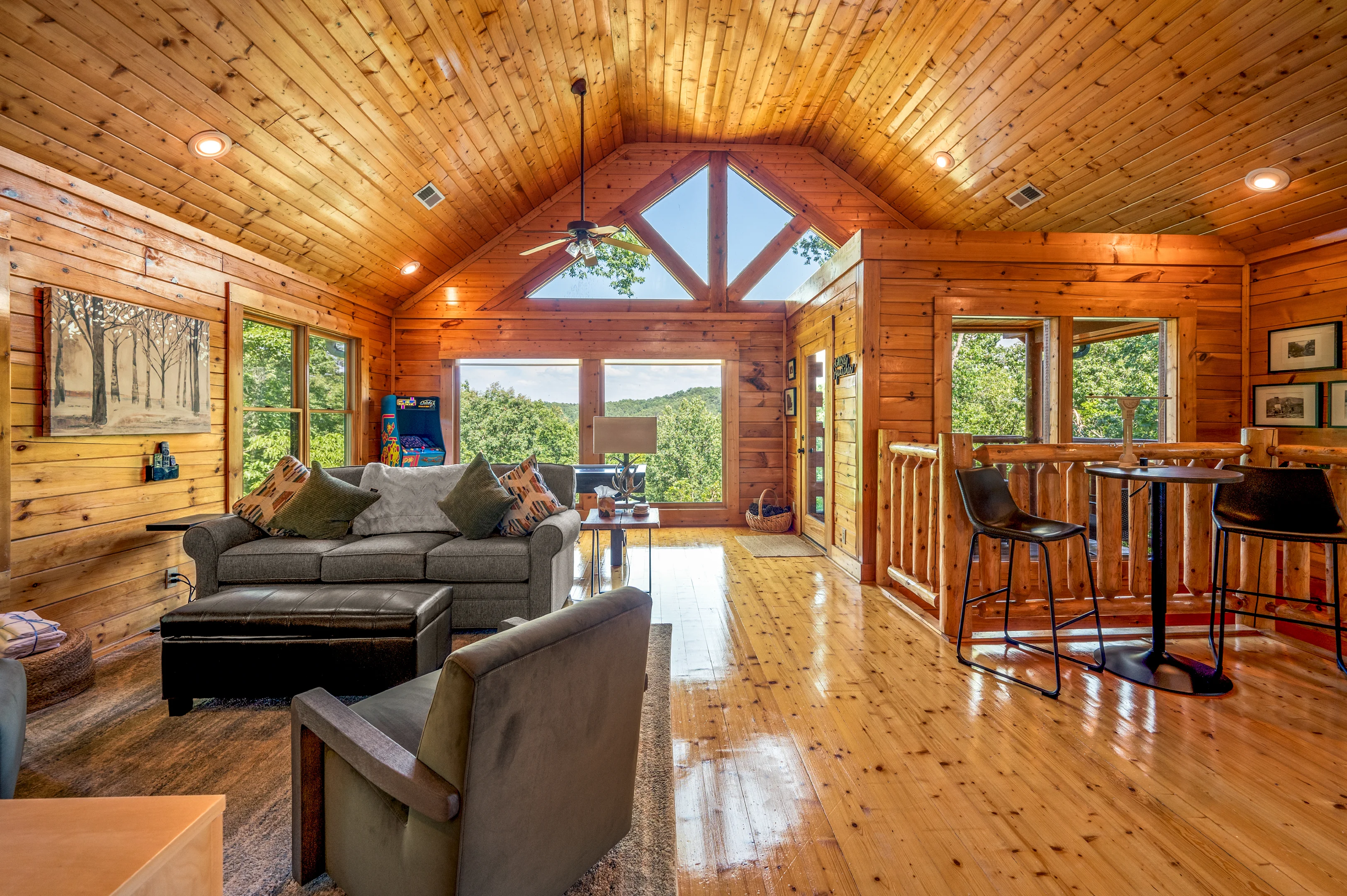
Where Should You Stay for the Best Access to Smoky Mountains Trails?
Your cabin’s location directly determines how early you can reach trailheads and whether you beat the parking rush. Gatlinburg-area cabins offer the shortest drive to the main park entrance and high-elevation trailheads. Pigeon Forge properties provide quick access to the Greenbrier and Cosby entrances on the northeast side, as well as the Cades Cove entrance via the US-321 corridor.
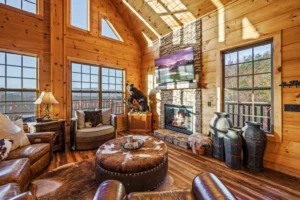
Gatlinburg Enchantment, a 3-bedroom log cabin in the Hemlock Hills Resort community near the Arts and Crafts Community, sits roughly 12 minutes from the Laurel Falls trailhead and about 30 minutes from Newfound Gap, the starting point for Charlies Bunion. It sleeps up to 10 guests, which makes it a strong base camp for groups doing multi-day hiking itineraries across different sections of the park.
For larger groups who need space for 12 or more hikers returning from a long day on the trail, Mountain View Manor in Gatlinburg’s Chalet Village sits roughly 5 minutes from the park boundary with 3,800 square feet, four en-suite king bedrooms, and a hot tub on multiple decks. After a 13-mile Rocky Top hike, that hot tub earns its keep.
Couples planning to focus on Alum Cave Trail and the Gatlinburg entrance trails will find Chase N Moose in the Cobbly Nob resort particularly well-positioned, with the park entrance roughly 2 minutes away. The cabin sleeps up to 6 guests across two private king suites, with a whirlpool tub that makes the perfect post-hike recovery.
For families who want a mix of hiking days and attraction days, three-bedroom cabins from Hemlock Hills in the Pigeon Forge area put you within 15-25 minutes of most major trailheads while keeping Dollywood and Pigeon Forge attractions equally close. Browse the full Smoky Mountain Vacation Planner for a complete tool to match your group’s priorities to the right cabin location.
Frequently Asked Questions About Great Smoky Mountains National Park Hiking Trails
Do you need a permit to hike in Great Smoky Mountains National Park?
No permit is required for day hiking in Great Smoky Mountains National Park, and the park charges no entrance fee. A free backcountry permit is required for anyone camping overnight on the trail. You can obtain backcountry permits through the park’s online reservation system at nps.gov/grsm. LeConte Lodge requires a separate reservation and is typically booked months in advance.
What is the easiest hike in the Smokies with a big payoff?
Spruce Flat Falls is 2 miles roundtrip with a 30-foot waterfall and very light crowds compared to the park’s more marketed trails. Andrews Bald is slightly more demanding at 3.5 miles roundtrip but delivers panoramic open-bald views from near the Clingmans Dome parking area. Both are excellent choices for hikers who want scenery without a full-day commitment, provided Clingmans Dome Road is open for Andrews Bald.
What is the most popular hike in Great Smoky Mountains National Park?
Laurel Falls Trail is widely cited as the most-visited trail in the park, drawing large crowds because of its paved surface, short 2.6-mile roundtrip distance, and well-known waterfall destination. Alum Cave Trail to Mount LeConte is arguably the park’s most famous strenuous hike, rated as the shortest and steepest of the six routes to LeConte’s summit. Both trailhead parking areas fill before 9 AM on summer and fall weekends.
Which trails are suitable for wheelchairs or strollers in the Smokies?
Sugarlands Valley Nature Trail is a 0.5-mile paved loop near the Sugarlands Visitor Center and is the park’s most accessible trail for wheelchairs and strollers. The Gatlinburg Trail is another relatively flat option near the main entrance. Most other trails in the park involve unpaved, rocky, or rooted surfaces that are not suitable for mobility devices, so these two are the primary options for visitors with mobility limitations.
When does Clingmans Dome Road close, and how does it affect hiking?
Clingmans Dome Road typically closes from late November through late March each year. When the road is closed, Andrews Bald transforms from a 3.5-mile roundtrip day hike into a roughly 20-mile roundtrip route via the Appalachian Trail from Newfound Gap. If Andrews Bald is on your list, plan your trip between April and November to access the road. Always confirm current road status on the NPS website before departing.
Is Rocky Top Trail difficult, and what should I know before attempting it?
Rocky Top via the Appalachian Trail to Thunderhead Mountain is 13.9 miles roundtrip with 3,655 feet of elevation gain, making it one of the most demanding day hikes in the park. Most hikers should budget a full 8-10 hours for the roundtrip. Trekking poles are strongly recommended for the steep descent. Afternoon thunderstorms are common from May through September; plan to leave exposed ridgeline areas by 2 PM. This trail is not suitable for beginners or young children.
What should I bring on a day hike in Great Smoky Mountains National Park?
The essentials for any Smokies day hike are: at least 2 liters of water per person, trail-appropriate footwear with ankle support, rain gear (afternoon storms are frequent), a basic first aid kit, and a trail map downloaded offline. Bear spray is optional but recommended for solitary hikers on remote trails. High-elevation trails above 5,000 feet require microspikes or traction devices from November through April. Always review the official NPS hiking safety guidelines before any strenuous hike.
Are pets allowed on hiking trails in Great Smoky Mountains National Park?
Pets are allowed in the park but are restricted from most trails. Dogs are permitted on only two trails within the park boundaries: the Gatlinburg Trail and the Oconaluftee River Trail. Dogs must remain on a leash no longer than 6 feet at all times. All other backcountry trails, including every trail mentioned in this guide, prohibit pets. If you are traveling with a dog, plan pet-friendly day activities outside the park and check out pet-friendly cabins that can accommodate your whole family.
The Bottom Line on Hiking in the Smokies in 2026
Great Smoky Mountains National Park remains one of the most accessible and rewarding hiking destinations in the United States, partly because it charges no entrance fee and requires no day-hike permit. The 800-plus miles of trails give you genuine options at every fitness level, from a flat paved nature loop to a 14-mile ridge summit. The key in 2026, with visitation continuing to grow, is logistics: arrive early, check the NPS closure page the morning of your hike, and consider weekday visits if your schedule allows.
Pick one strenuous trail as your week’s centerpiece (Alum Cave to LeConte is the most rewarding for the distance), one moderate trail for a second full day (Charlies Bunion or Abrams Falls), and fill remaining mornings with shorter options like Spruce Flat Falls or Porters Creek. That structure gives you variety without repeated 6 AM alarms and lets you actually enjoy the cabin you booked.
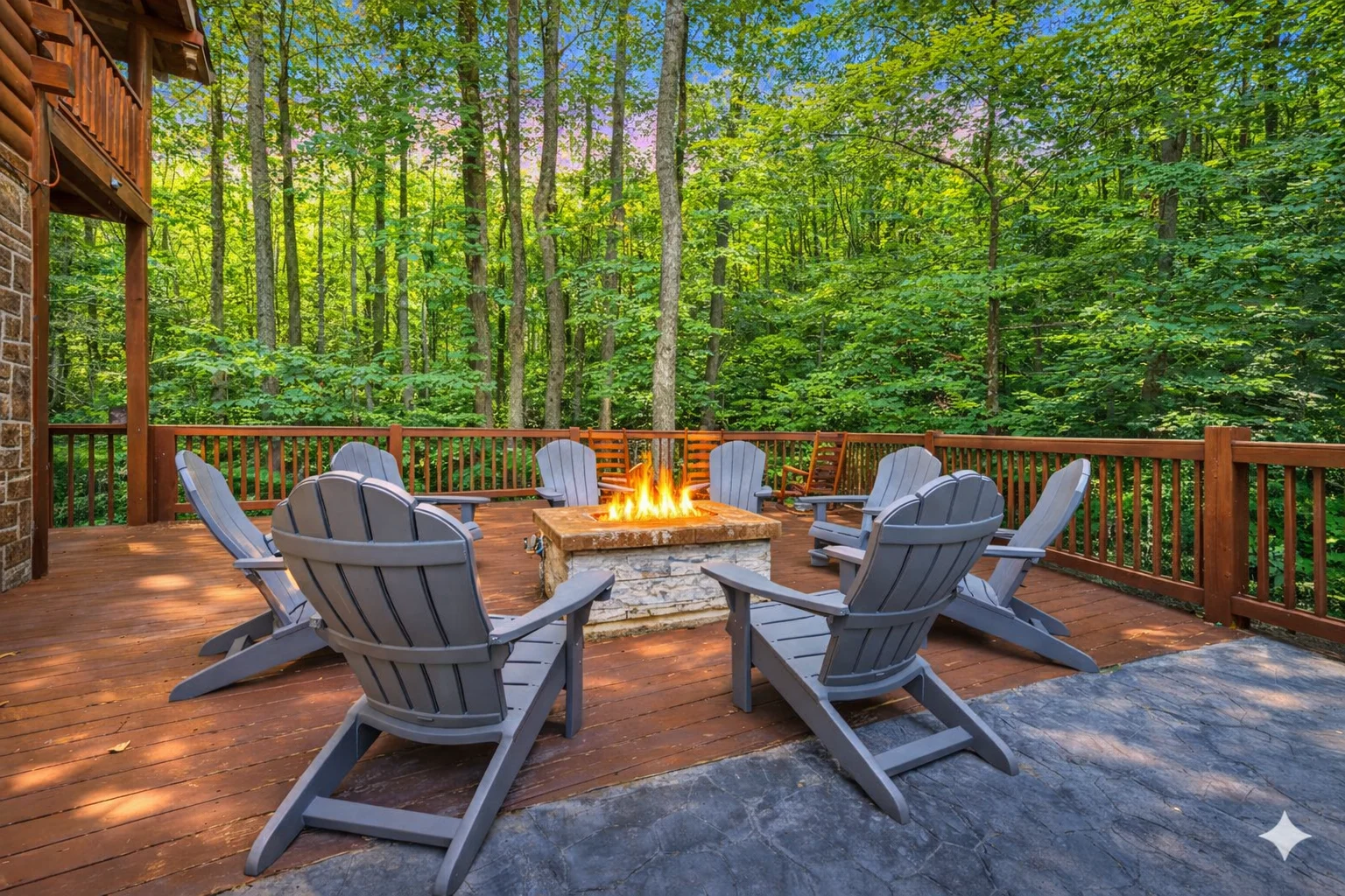
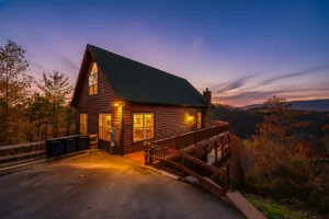
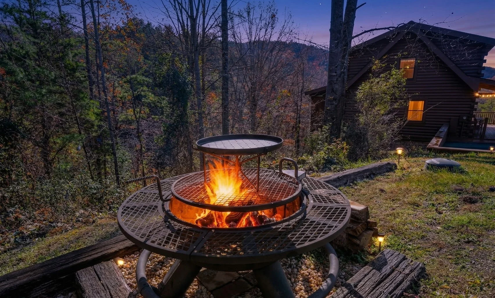
After a full day on Great Smoky Mountains National Park hiking trails, Forest Creek Retreat puts you back in the woods without ever leaving your deck. The fire pit and hot tub are the right way to end a trail day, and the cabin sits roughly 12 minutes from the park entrance. Check availability at Forest Creek Retreat for your dates, or browse the full selection of Gatlinburg cabins to find the right fit for your group size and hiking schedule.