
Great Smoky Mountains National Park contains over 800 miles of smoky mountain hiking trails spread across approximately 150 official routes, making it the most visited national park in the United States. Trails range from a 2-mile stroll to Spruce Flat Falls to the strenuous 13.9-mile Rocky Top climb. For most visitors, the sweet spot sits in the moderate-difficulty category: enough elevation gain to earn the views, manageable enough for families and first-timers.
- Great Smoky Mountains National Park has over 800 miles of trails across roughly 150 official hiking routes, plus 71 miles of the Appalachian Trail running through the park.
- Trail difficulty ranges from easy (Spruce Flat Falls, 2 miles) to strenuous (Rocky Top at 13.9 miles roundtrip with 3,655 feet of elevation gain).
- The park is free to enter and requires no day-use permit for most trails, but backcountry camping and LeConte Lodge stays require advance reservations.
- Wildlife in the park extends far beyond black bears: the Cataloochee area supports elk herds, and GSMNP is one of the world’s premier salamander biodiversity hotspots.
- Most Smokies trails run out-and-back, with very few loop options. Plan your turnaround time before you start, especially on strenuous routes.
- Cabins less than 15 minutes from popular trailheads let you start early, beat the parking rush, and soak in the hot tub when your legs are done.
What Makes Smoky Mountain Hiking Trails Worth the Trip?
Great Smoky Mountains National Park is the most visited national park in the United States, drawing over 12 million visitors annually according to the National Park Service. The park straddles the Tennessee and North Carolina border, was designated a UNESCO World Heritage Site in 1983, and contains more than 1,500 species of flowering plants. Those numbers matter because they explain both the park’s extraordinary appeal and its biggest practical challenge: crowds.
The trail network rewards every fitness level. Families with young children find accessible waterfall hikes just a short drive from Gatlinburg. Serious hikers connect to the Appalachian Trail and push toward balds with 360-degree views. In between sit dozens of moderate routes past old-growth hemlocks, historic farmsteads, and cascades that flow year-round.
For 2026, the park continues to see strong visitation. Sevier County generated $3.93 billion in visitor spending in 2026 alone, according to the Tennessee Department of Tourist Development. That level of traffic means planning your hikes strategically, particularly around parking and start times, matters more than ever.
What Is the Best Hike in the Smoky Mountains?
The best hike in the Smoky Mountains depends on your fitness level and what you want to experience. For most visitors, Alum Cave Trail to Mount LeConte (11.0 miles roundtrip, 2,763 feet elevation gain) offers the most dramatic variety per mile: you pass through Arch Rock, traverse a dramatic bluff face 80 feet high, and reach LeConte Lodge at the summit, a structure built in the 1920s that remains accessible only by trail. For families, Laurel Falls Trail and Abrams Falls deliver the most reward for the least effort.
The Top Trails at a Glance
| Trail | Distance (RT) | Difficulty | Elevation Gain | Highlight |
|---|---|---|---|---|
| Spruce Flat Falls | 2.0 mi | Easy-Moderate | Moderate | 30-ft cascade, low crowds |
| Andrews Bald | 3.5 mi | Moderate | 899 ft | Open grassy bald, panoramic views |
| Chimney Tops | 3.3 mi | Mod-Strenuous | 1,487 ft | Twin-peaked 4,724-ft summit |
| Alum Cave Bluff | 4.4 mi | Moderate | 1,125 ft | Dramatic bluff, Arch Rock passage |
| Porters Creek | 4.0 mi | Moderate | 699 ft | Historic farmsteads, Ownby Cemetery |
| Abrams Falls | 5.2 mi | Moderate | 675 ft | Powerful 20-ft waterfall, Cades Cove |
| The Jump-Off | 6.5 mi | Moderate | 1,275 ft | 1,000-ft cliff face of Mt. Kephart |
| Brushy Mountain | 6.8 mi | Strenuous | 1,745 ft | Wildflowers, waterfalls, mountain views |
| Charlies Bunion | 8.1 mi | Moderate | Varies | Exposed rock face, AT summit access |
| Ramsey Cascades | 8.0 mi | Mod-Strenuous | Significant | 90-ft waterfall, old-growth trees |
| Gregory Bald | 11.3 mi | Strenuous | 2,300 ft | Panoramic bald, wild azaleas in June |
| Mt. LeConte via Alum Cave | 11.0 mi | Strenuous | 2,763 ft | LeConte Lodge, Myrtle Point sunrise |
| Mt. Cammerer | 11.1 mi | Strenuous | 3,045 ft | 360-degree views from lookout tower |
| Rocky Top/Thunderhead Mtn | 13.9 mi | Strenuous | 3,655 ft | Views into North Carolina, AT crossing |
Two trails deserve a closer look because they consistently outperform their reputations. Porters Creek Trail (4.0 miles, moderate) threads past the Elbert Cantrell farmstead, Ownby Cemetery, and a cabin the Smoky Mountain Hiking Club built in the mid-1930s. It gets a fraction of the traffic that Laurel Falls draws, yet the historical texture rivals any trail in the park. You can find a detailed breakdown at the Porters Creek Trail guide from hikinginthesmokys.com.
Spruce Flat Falls, located just across from Tremont Visitors Center, covers only 2 miles roundtrip and drops to a 30-foot main cascade. Almost no competitor article mentions it. If you want a genuine low-crowd waterfall experience, this is the one to prioritize in 2026.
Can You Go Hiking in the Smoky Mountains?
Yes, you can hike in Great Smoky Mountains National Park year-round, and entry to the park is free. No day-use hiking permit is required for the vast majority of trails. The park is open 24 hours a day, 365 days a year, though specific roads (most notably the Clingman’s Dome Road) close seasonally, typically from late November through late March. Trail conditions vary significantly by season, so checking the GSMNP Visitor Centers page before you go is genuinely useful, not just a procedural recommendation.
Spring (March through May) brings wildflower blooms along trails like Porters Creek and Brushy Mountain, but also the heaviest rainfall and the muddiest trail surfaces. Summer draws the largest crowds, and trailhead parking lots at Laurel Falls and Alum Cave can fill before 9am on weekends. Arrive by 7:30am or plan an afternoon start when day-trippers are leaving. Fall foliage, typically peak from mid-October to early November at lower elevations, is the most popular season and also the most congested. Winter is genuinely underrated: crowds drop sharply, the bare canopy opens up long views, and ice formations along stream crossings are worth the cold.
One practical detail almost every guide misses: backcountry camping requires a permit and a reservation through the park’s online system. Front-country day hiking does not. If you plan to stay overnight at a backcountry site, reserve early. LeConte Lodge, the only trail-accessible overnight lodging in the park, books months in advance and operates seasonally, generally from March through late November.
What Famous Hiking Trail Passes Through the Great Smoky Mountains?
The Appalachian Trail passes directly through Great Smoky Mountains National Park, covering 71 miles of its total length within the park’s boundaries. This section of the AT runs along the Tennessee-North Carolina state line, crossing the park’s highest ridgeline and passing near several of the most popular summit destinations. Newfound Gap, accessible by car via Newfound Gap Road (US-441), serves as the most accessible AT trailhead in the park and the launch point for hikes to both Charlies Bunion and Andrews Bald.
Charlies Bunion (8.1 miles roundtrip from Newfound Gap) follows the AT northeast to an exposed quartzite rock face. The bunion formation itself is the product of a fire and flood roughly a century ago that stripped trees and soil from the ridge, leaving the bare rock visible. Chimney Tops’ distinct twin-peaked profile, at 4,724 feet, gained cultural recognition when its silhouette appeared on the cover of Horace Kephart’s classic book “Our Southern Highlanders.” For a deeper look at that route, the Rocky Top and Thunderhead Mountain trail guide covers the full 13.9-mile push to the summit.
The AT in GSMNP is well-marked and well-maintained, but it is not flat or easy. The ridge it follows sits consistently above 5,000 feet, and temperatures up there run 10 to 15 degrees cooler than at the trailhead. Pack layers regardless of the forecast in the valley below.
How Do You Hike to Mount LeConte?
Mount LeConte is the third-highest peak in Great Smoky Mountains National Park and the destination of the park’s most famous overnight experience, LeConte Lodge. Six distinct routes reach the summit, each with different distances and character. The Alum Cave Trail (11.0 miles roundtrip, 2,763 feet gain) is the most popular because it packs the most dramatic scenery into the most direct route: Arch Rock, the sweeping Alum Cave Bluff at 80 feet high, and Inspiration Point before the final push to the lodge.
For additional route options and logistics, the Mount LeConte trail guide from RootsRated breaks down all six approaches, which matters if the Alum Cave parking area is full (it often is by 8am on summer weekends). The Boulevard Trail and Rainbow Falls route offer legitimate alternatives with different crowd dynamics.
At the summit, LeConte Lodge operates a small collection of cabins and a central dining building. Hot chocolate on a cold morning at Myrtle Point, considered the best sunrise vantage in the park, is one of those experiences that earns its reputation. But the lodge books months in advance. Check availability as soon as your travel dates are firm.
Guests staying at A Southern Point of View in the Cobbly Nob community have the Laurel Falls trailhead roughly 1.2 miles from the cabin, making an early-morning pre-crowd start genuinely achievable without a long drive.
Is Hiking Good for Blood Pressure?
Hiking is widely recognized by exercise physiologists and health organizations as an effective form of moderate aerobic activity that supports cardiovascular health, including blood pressure regulation. The combination of sustained moderate-intensity exercise, reduced stress hormones, and time in natural settings produces measurable physiological benefits for most adults. That said, hiking in Great Smoky Mountains National Park involves real physical demands that anyone with a health condition should consider before heading out.
What Should You Know Before You Go?
Elevation and cardiovascular strain: Even moderate Smokies trails gain several hundred feet of elevation. Strenuous routes like Rocky Top (3,655 feet gain) place significant demands on the cardiovascular system. If you have high blood pressure, heart disease, or have been sedentary, start with genuinely easy trails like Spruce Flat Falls or the Gatlinburg Trail and talk to your doctor before attempting anything rated strenuous.
Heat and hydration: Summer temperatures in the park’s lower valleys can reach the mid-80s Fahrenheit. Dehydration raises blood pressure and makes every uphill section harder. Carry at least 2 liters of water per person for any trail over 4 miles. Stream water looks clean but must be filtered or treated before drinking.
Altitude at higher elevations: The park’s upper ridgeline sits above 6,000 feet in places. Most hikers feel no significant effects at these elevations, but people with severe respiratory conditions may notice reduced oxygen availability on strenuous climbs. If you normally live at sea level, pace yourself on the first day.
Wildlife and bear safety: Black bears are active throughout the park. The NPS recommends maintaining a minimum distance of 50 yards and never feeding wildlife. Carry bear spray if you plan backcountry routes. The official NPS hiking safety guidelines cover bear encounters, stream crossings, and thunderstorm protocols in practical detail.
Wildlife beyond bears: Competitors rarely mention this, but GSMNP is one of the world’s premier salamander biodiversity hotspots, home to more than 30 species. The Cataloochee Valley area supports a recovering elk herd, typically most visible at dawn and dusk. Synchronous firefly events in late May and early June draw large visitor numbers to specific campground areas and require a separate vehicle permit during peak display nights.
How Do You Avoid Crowds on Smoky Mountain Trails?
Crowd avoidance on smoky mountain hiking trails requires specific, trail-level planning rather than general seasonal advice. Most competitor guides note that certain trails are busy, without explaining when or how to adjust. Here is actionable data by trail type.
Highest-traffic trailheads (Laurel Falls, Alum Cave, Chimney Tops): Parking lots fill before 9am on summer and fall weekends. Arrive by 7am or plan a Tuesday-Thursday visit. There is no overflow parking system, and parking on the road shoulder often leads to citations. If the lot is full, drive to Newfound Gap or Smoky Mountain Guides for a guided route that uses a shuttle, bypassing the trailhead parking problem entirely.
Genuinely lower-traffic alternatives: Spruce Flat Falls near Tremont Visitors Center, Porters Creek Trail in the Greenbrier area, and the Rich Mountain Loop inside Cades Cove (accessed on foot rather than driving the loop road) all offer comparable scenery to the popular trails with a fraction of the foot traffic.
Before any visit, check the NPS trail conditions page for current closures. Trail closures in the Smokies result from storm damage, bear activity, landslides, and seasonal road access restrictions. No competitor article explains how to check this proactively: go to nps.gov/grsm and look under “Alerts” for the current list. A closed trail you discover in the parking lot is a wasted hour and a frustrated group.
Smoky Mountain Guides offers guided hikes starting at $45 for a 3-hour easy route and up to $75 for a 6-hour moderate remote waterfall experience that uses a shuttle to reach 6,000-foot elevations. Guided options solve the parking problem entirely and add natural history context that transforms a hike from exercise into an experience.
How Should Families and First-Timers Choose a Trail?
Families with children and first-time Smokies visitors should focus on four trails that deliver maximum reward with manageable demands: Spruce Flat Falls (2 miles, easy-moderate), Alum Cave Bluff as a partial hike (4.4 miles to the bluff, skipping the summit), Abrams Falls (5.2 miles, moderate, in Cades Cove), and Andrews Bald (3.5 miles, moderate, from Clingman’s Dome parking). Each of these offers a clear visual destination, well-maintained trail surfaces, and turnaround options that let you cut the hike short if the group runs low on energy.
Stroller and accessibility note: Most Smokies trails are unpaved backcountry paths unsuitable for strollers. The Gatlinburg Trail (2 miles roundtrip, paved sections) is the most stroller-friendly option in the park and stays close to town. The Oconaluftee River Trail on the North Carolina side is another accessible choice. For visitors with mobility limitations, the Clingman’s Dome observation tower ramp is paved but steep, and the Andrews Bald trailhead sits at the end of a road that closes in winter.
Footwear matters more than most guides admit: Trail runners or light hiking boots with ankle support work well for most moderate Smokies trails. Road shoes and sandals are genuinely problematic on wet rock surfaces and root-covered trails after rain. The park’s high rainfall (some areas receive 85 inches annually) means wet conditions are the default, not the exception.
For a deeper orientation to the park before you plan specific hikes, the Guide to the Great Smoky Mountains National Park from RootsRated provides solid context on park layout and seasonal planning.
Where Should You Stay to Access Smoky Mountain Hiking Trails?
The best base for smoky mountain hiking trails is a cabin or rental within 15 to 25 minutes of the main park entrances at Gatlinburg and Townsend, giving you the flexibility to start early, return for lunch, and head back out in the afternoon. Hotels along the Pigeon Forge Parkway work for families focused on Dollywood, but the extra 20-30 minutes of morning drive time to the Laurel Falls or Alum Cave trailheads adds up across a multi-day hiking trip.
The Spirit Bear: A Gatlinburg Base Built for Hikers
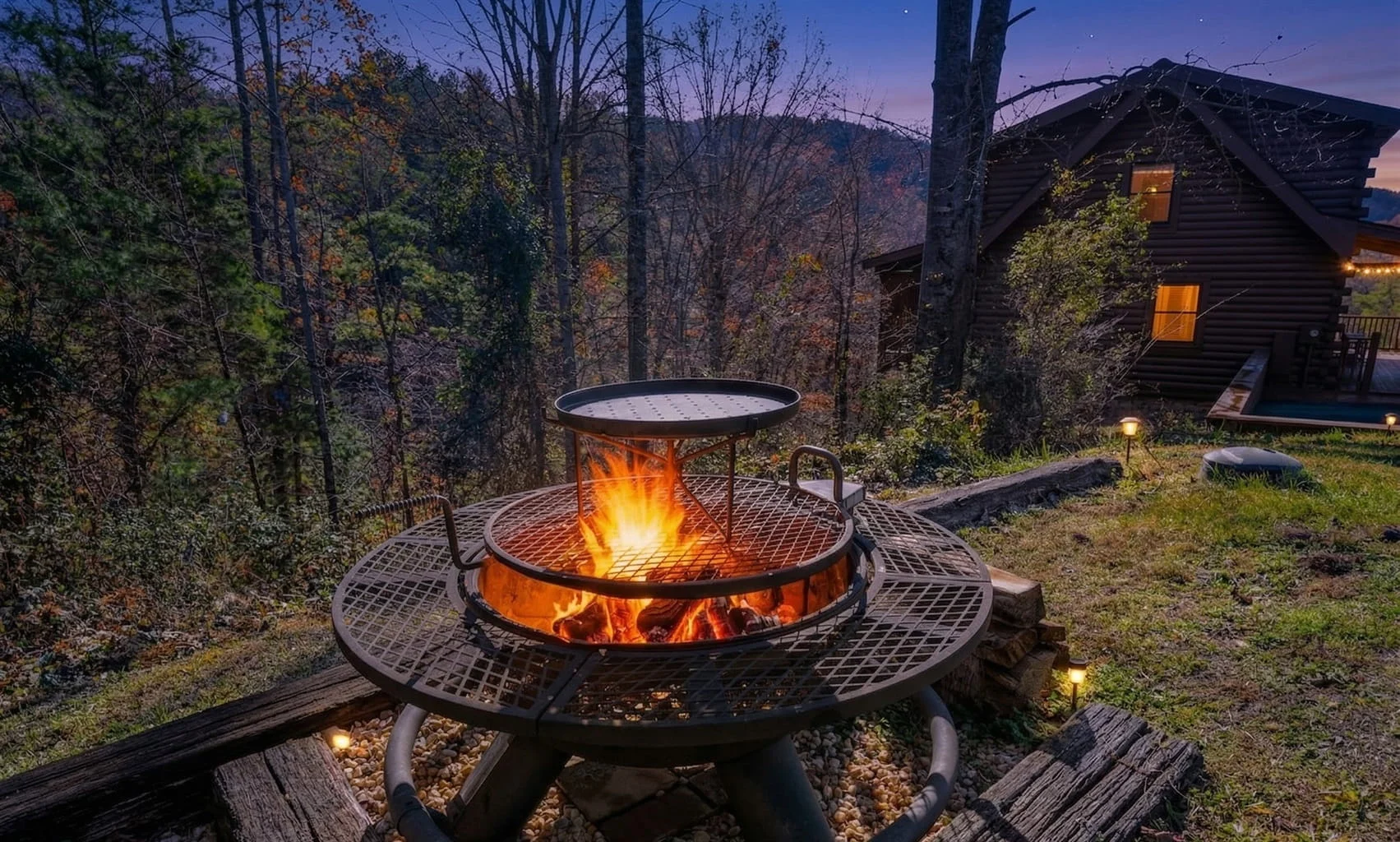
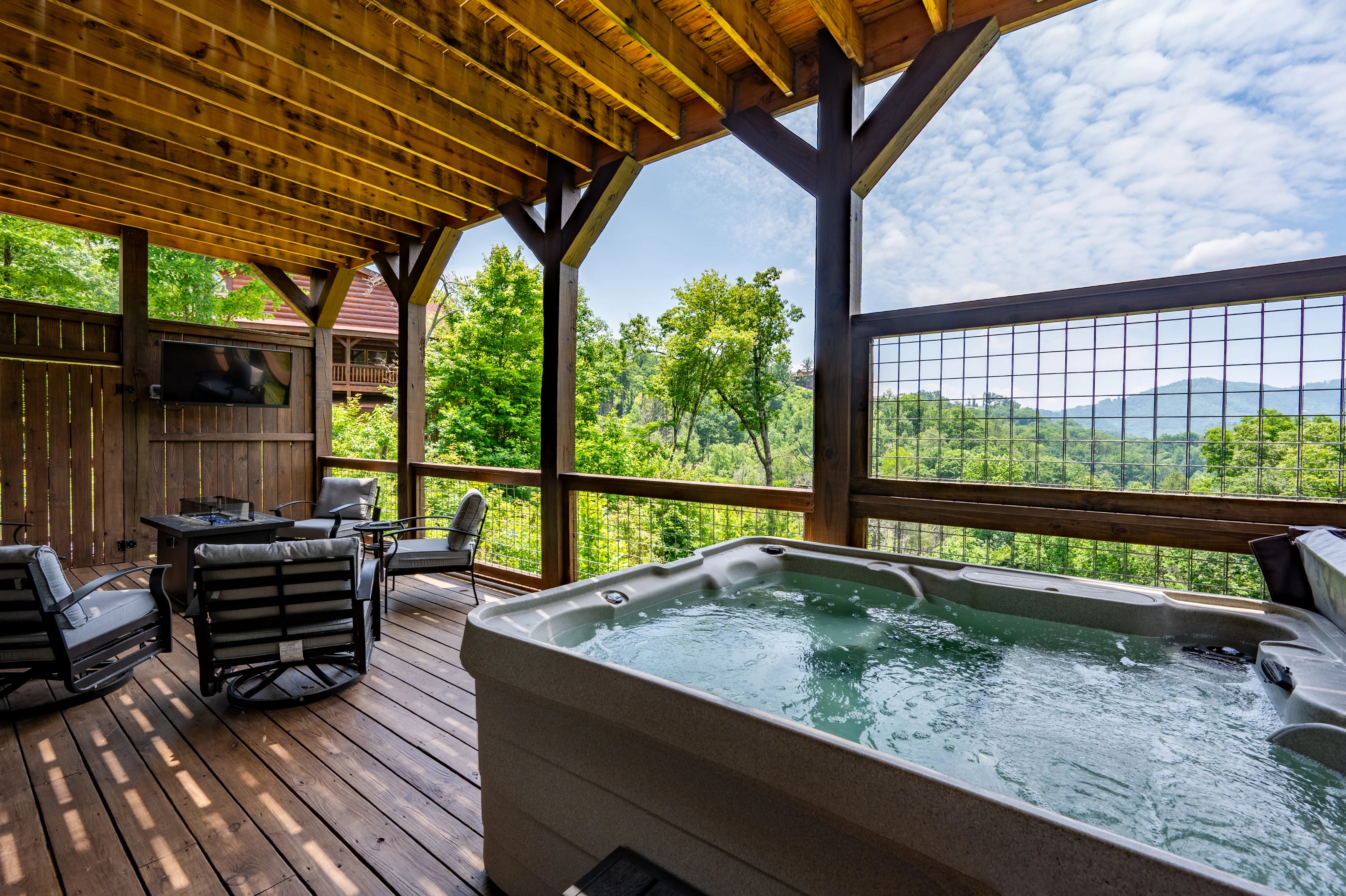
The Spirit Bear sits in Gatlinburg’s Arts and Crafts Community, 2.1 miles from the Great Smoky Mountains National Park entrance and less than 5 minutes from downtown Gatlinburg. This 3-bedroom, 3-bathroom cabin sleeps 8 and was built as new construction with vaulted ceilings, a stone fireplace, and two expansive covered decks with wooded views. The private hot tub and outdoor fire pit make the evenings genuinely restorative after a long day on the trails.
At 0.6 miles from the Gatlinburg Parkway, you can walk to dinner rather than drive. Laurel Falls trailhead sits 8.5 miles away, roughly 15 minutes, and Cataract Falls Trail is 6.2 miles out. Book The Spirit Bear for any trip centered on Gatlinburg-side trails.
A Southern Point of View: Cobbly Nob Access to Laurel Falls
A Southern Point of View offers three king bedrooms, a 70-plus-game arcade with a pool table, and a private hot tub with mountain views, all within the secured Cobbly Nob resort with 24-hour security. The Laurel Falls Trail is just 1.2 miles from the cabin and Alum Cave Bluff sits 2.5 miles away. The resort’s community pool is about 200 feet from the front door. For groups of up to 8 who want quick trail access without sacrificing evening entertainment, this is the most practical option in the portfolio.
Mountain View Manor: Full-Scale Luxury Near the Park
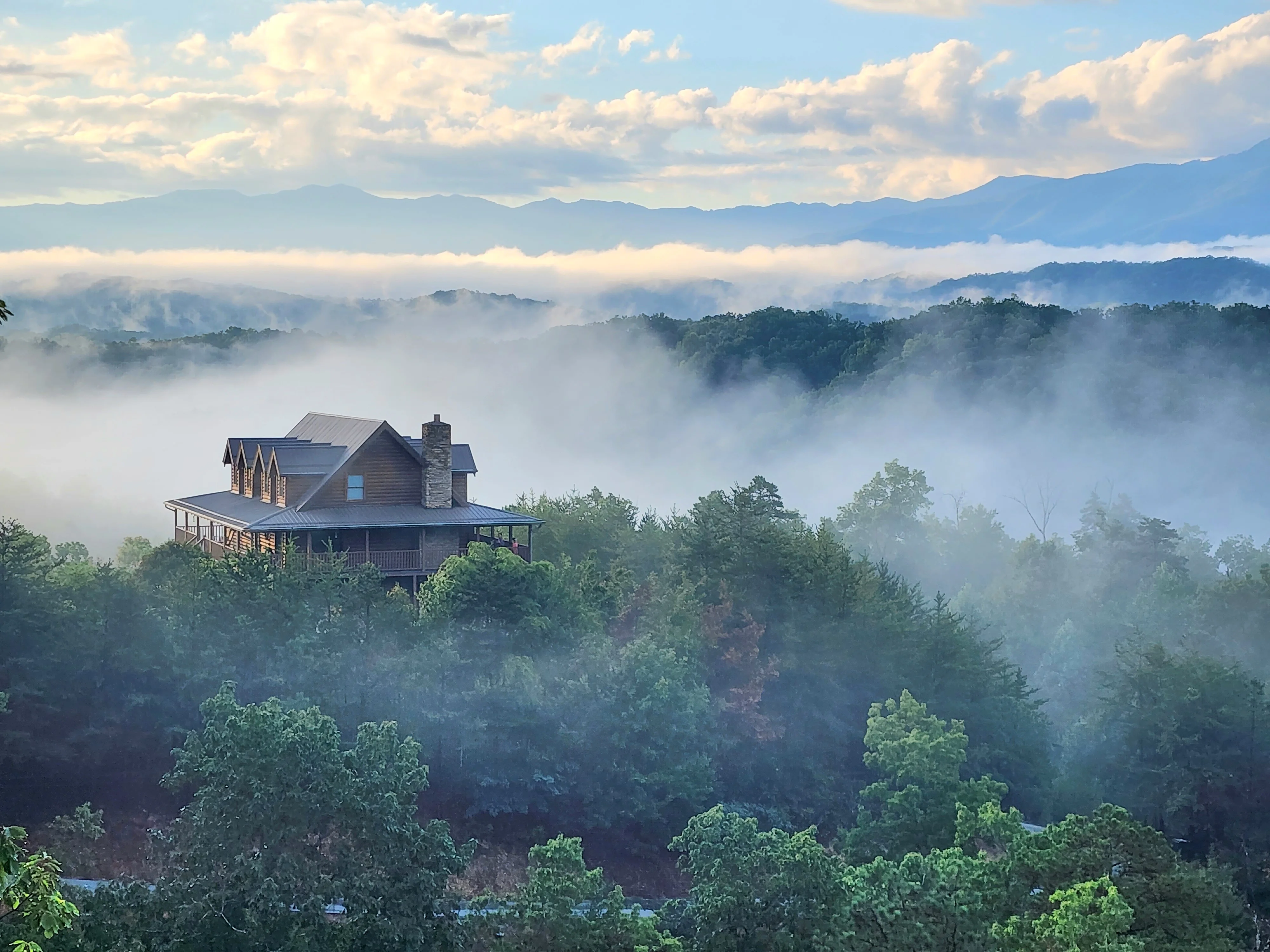
Mountain View Manor in Gatlinburg’s Chalet Village community covers 3,800 square feet across 4 bedrooms and 5 bathrooms, sleeping up to 18 guests. The Great Smoky Mountains National Park entrance sits 0.5 miles away, and Cataract Falls Trail is roughly 10 minutes out. The property includes a home theater, a game room with arcade games and pool table, and a hot tub with fire pit on the deck. For large family groups or multi-generational trips that want the park essentially at the doorstep, this cabin delivers.
Browse the full range of Gatlinburg cabins if you want to compare proximity and capacity options across the portfolio.
Can’t Bear To Leave: Close to the Pigeon Forge Entrance
Can’t Bear To Leave positions you 2.8 miles from the national park entrance, 10 minutes to Pigeon Forge, and 20 minutes to Gatlinburg. The 3-bedroom, 4-bathroom cabin sleeps 11 and features a private indoor heated pool, a slate pool table, and panoramic mountain views through floor-to-ceiling windows. Laurel Falls is accessible in about 15 minutes. For families who want trail access and a pool on rainy days, this property handles both without compromise.
If you prefer a Sevierville base or need more bedrooms, check the Sevierville cabins and Pigeon Forge cabins pages for additional options by location.
Frequently Asked Questions About Smoky Mountain Hiking Trails
Do you need a permit to hike in Great Smoky Mountains National Park?
No permit is required for day hiking on any trail in Great Smoky Mountains National Park. Entry to the park is free and unrestricted year-round. Backcountry camping does require a permit and advance reservation through the NPS reservation system, and LeConte Lodge overnight stays require reservations made months in advance due to very limited availability.
What is the easiest hike in the Smoky Mountains for families with young children?
Spruce Flat Falls (2 miles roundtrip, easy-moderate) near Tremont Visitors Center is the most family-friendly option with low crowds. The Gatlinburg Trail (roughly 2 miles, partially paved) is the most accessible for young children and strollers. For a waterfall destination with manageable terrain, Abrams Falls in Cades Cove (5.2 miles, moderate, 675 feet elevation gain) works well for school-age children and older.
When is the best time of year to hike in the Smoky Mountains?
Each season offers a genuinely different experience. Spring brings wildflower blooms from March through May but also the heaviest rain and muddy trails. Summer is the busiest season, with trailhead parking lots filling before 9am on weekends. Fall foliage peaks from mid-October to early November and draws the largest crowds. Winter is the most underrated season: sharp views through the bare canopy, dramatically lower crowds, and ice formations along stream trails that rival any other season visually.
How long does it take to hike Alum Cave Trail to Mount LeConte?
The Alum Cave Trail to the LeConte summit and back (11.0 miles roundtrip, 2,763 feet elevation gain) takes most fit hikers 7 to 9 hours. The hike to Alum Cave Bluff only (4.4 miles roundtrip) typically takes 2 to 3 hours. Start before 8am to secure parking at the Alum Cave trailhead, which fills quickly on weekends during summer and fall.
Are there any wildlife beyond black bears to watch for on Smoky Mountain trails?
Yes. The Cataloochee Valley area supports a recovering elk herd, most visible at dawn and dusk. GSMNP is one of the world’s premier salamander biodiversity hotspots, home to more than 30 species. Synchronous firefly events in late May and early June in specific campground areas draw large visitor numbers and require a separate vehicle permit during peak display nights. Wild turkeys are commonly seen on lower-elevation trails throughout the year.
What is the hardest hike in Great Smoky Mountains National Park?
Rocky Top via the Thunderhead Mountain trail is the most demanding commonly hiked route in the park at 13.9 miles roundtrip with 3,655 feet of elevation gain. It crosses the Appalachian Trail summit and provides views into North Carolina. Mount Cammerer (11.1 miles, 3,045 feet gain) rivals it in difficulty and rewards hikers with 360-degree panoramic views from a historic stone fire lookout tower accessible from Cosby Campground or Big Creek. Both trails require a full day and solid fitness preparation.
How do I check trail closures before hiking in the Smokies?
Visit nps.gov/grsm and check the “Alerts” section for current trail closures before any visit. Closures result from storm damage, bear activity concentrations, landslides, and seasonal road access restrictions (most notably Clingman’s Dome Road, which closes from late November through late March). Stopping at a park visitor center on arrival is also reliable for same-day conditions. The GSMNP Visitor Centers page lists all center locations and hours.
Can I take my dog on Smoky Mountain hiking trails?
Dogs are permitted on only two trails within Great Smoky Mountains National Park: the Gatlinburg Trail and the Oconaluftee River Trail (North Carolina side). All other trails in the park prohibit pets, regardless of leash status. If you are traveling with a dog, choose a cabin base outside the park and plan your pet-free hiking separately. Several Hemlock Hills Cabin Rentals properties, including Bear View and Little Bear, welcome dogs and are located within a reasonable drive of the park entrances.
Planning Your Smoky Mountain Hiking Trip in 2026
Smoky Mountain hiking trails offer more variety per square mile than almost any other national park in the country, from a 2-mile waterfall stroll to a 14-mile Appalachian Trail summit crossing. The practical keys to a successful trip in 2026 are simple: arrive at popular trailheads before 9am, verify trail conditions before you leave, carry more water than you think you need, and build in flexibility for closures.
For a broader overview of how to structure your entire Smokies visit around both hiking and local attractions, the Smoky Mountain Vacation Planner covers logistics, seasonal timing, and what to do on days when the trails are wet or closed.
Choose your base carefully. The difference between a 5-minute drive to the Alum Cave trailhead and a 40-minute drive from Pigeon Forge is the difference between a relaxed early start and a race against the parking lot.
If you are planning a hiking-focused trip, The Spirit Bear in Gatlinburg’s Arts and Crafts Community sits 2.1 miles from the park entrance, putting every major trailhead within a 15-minute drive. After a full day on the trail, the private hot tub and fire pit make the recovery feel earned. Check availability at The Spirit Bear for your dates.